1 Introduction
According to the overall deployment of the State Oceanic Administration, the marine economic assessment and islands comprehensive development risk management system is designed to build a fully covered monitoring network, establish a marine economic information resource pool, and build a data exchanging and sharing platform for monitoring, assessment, geographic information sharing of marine economic operations.
2. The system architecture
Based on the SuperMap 2D and 3D integration platform, the system can realize the comprehensive analysis and evaluation of marine economic operation data acquisition and the displaying of the marine economy operation status through advanced interactive chart technology, modeling technology and GIS platform technology.
3.1 The functions
The basic operation: It is required to implement the GIS map operation function, which can support a series of functions such as displaying full image, direct zooming, zooming out, roaming, eagle eye, fast positioning, map panning, and map printing output, as well as the selection and overlay of the various layers.
3.2 The data displaying
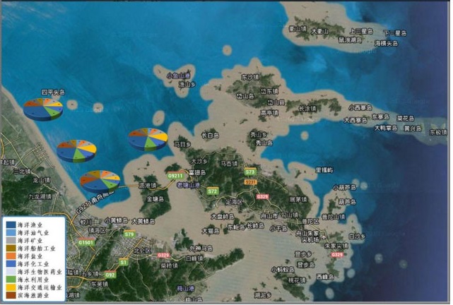
The ocean data display, monthly report data display, enterprise data display, marine statistical indicator display can be achieved on 2D and 3D integration platform, and GIS template management can be used to implement the adding, deleting, changing, and checking operations on “area data displaying” template.
3.3 The data acquisition and processing model
The data collection and processing model is a comprehensive and systematic compilation of marine economic monitoring indicators data, which provides the basis information for marine economic monitoring and evaluation. The model is focus on the data cleansing, verification, and processing of missing data.
3.4 The monitoring model
The monitoring model demonstrates economic development, economic development and environment monitoring, economic and industrial monitoring, sea-related product price monitoring, and sea-related enterprise monitoring through regional indicator setting, query conditions, distribution methods, chart display, data correction, and data export.
3.5 The economic evaluation model
The economic evaluation model demonstrates the comprehensive assessment, industrial development assessment, marine technology support assessment, comprehensive development assessment of coastal industrial clusters, and marine economic demonstration area through the functions of regional indicator setting, query conditions, distribution methods, chart display, data revision, and data export.
Satellite Tracking + Big Data GIS Application in Real-time Ship-controlling>
Big Data - Signaling Data Makes Cities Smarter>


