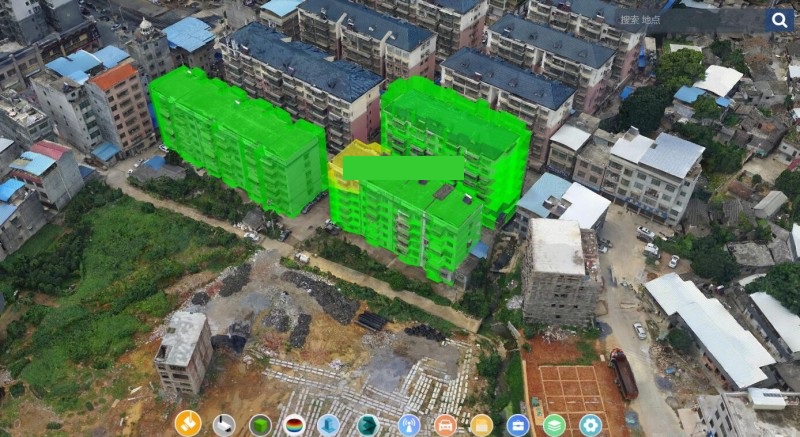
The project mainly constructs a real-time 3D geographic information platform with a total area of 10 square kilometers in the main city, and a 3D scene data model for building an indoor real scene of 50,000 square meters.
The real-scene 3D data acquisition can be realized through the technology of oblique photogrammetry. To perform the data processing on the 3D data of the real-scene and the singulation to realize the singularization of the room on the floor, so the specific room can be positioned from the real-scene 3D map and the docking with the community police information collection can be realized. The 3D laser point cloud scanning technology can be used to perform indoor 3D modeling of some key places. According to the requirements and specifications of “address, real population, real housing, real units” information collection, the improvement and standardization of a standard “address, real population, real housing, real units” data can be accomplished by cooperating with the police. The process correlates the “ real population, real housing, real units” information with the singular data to realize the full display of the “real population, real housing, real units” information on the 3D map. At the same time, based on the 3D map service, the core common business function modules can be built, such as the distribution of police services in the county, finding single person from family information or finding family from person information.
New 3D GIS Technology in Underground Water Management>
2D and 3D GIS in Natural Resources Management>
New 3D GIS Technology Supports the Construction of "Digital Twins" in Transportation>


