SuperMap has developed the CIM+ Urban Infrastructure Operation and Supervision System to address the core demands of new infrastructure and resilient city construction, such as data openness and integration.
15 May,2025 CIM infrastructure AI GIS AI Urban managementSuperMap has constructed a CIM platform leveraging key technologies such as 3D GIS, cloud-native GIS, cross-platform GIS, spatio-temporal data governance, and distributed storage and computing.
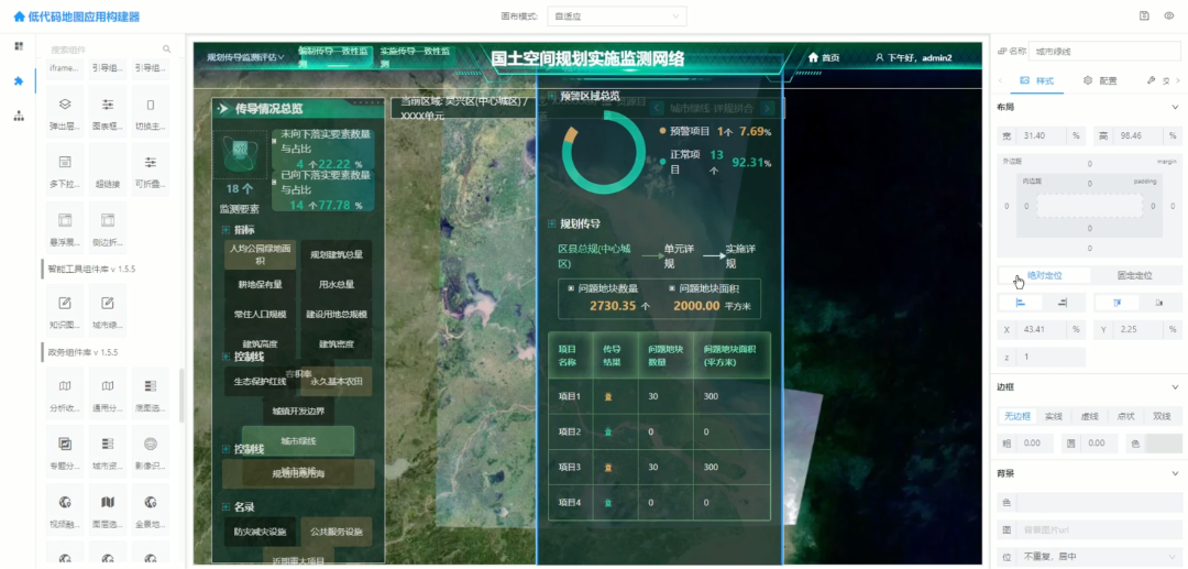
14 May,2025 housing SuperMap GIS CIM AI urban management urban planning urban design park management AI GISSuperMap proposes the Data Resource System + Digital Infrastructure Platform solution to accelerate digital transformation in the housing sector.
09 May,2025 digital transformation data resource infrastructure GIS housing SuperMapSuperMap GIS integrates four key techniques—rule-based modeling, procedural modeling, symbolic modeling, and AI-driven modeling—to enable efficient construction of 3D models ranging from individual geometric objects to urban buildings, roads, and utility networks.
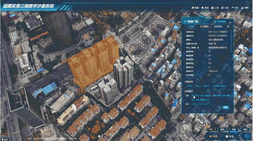
08 May,2025 urban design SuperMap 3D modeling SuperMap GISAfter over two decades of research, SuperMap has overcome key technical challenges such as multi-source heterogeneous 3D data fusion, distributed spatial computing, and cross-platform GIS compatibility in spatial platform.
30 Apr,2025 natural resource territory space remote sensing big data SuperMapThe Territorial Information Model (TIM) represents a transformative approach to spatial governance, merging cutting-edge technology with policy to address urbanization, environmental protection, and resource efficiency. Its role in shaping sustainable and...
25 Apr,2025 TIM SuperMap data foundation natural resourcesThe first phase of revolution demands courage. Without Chairman Zhong’s foresight, SuperMap might still be a GIS project company today—never a platform software enterprise.
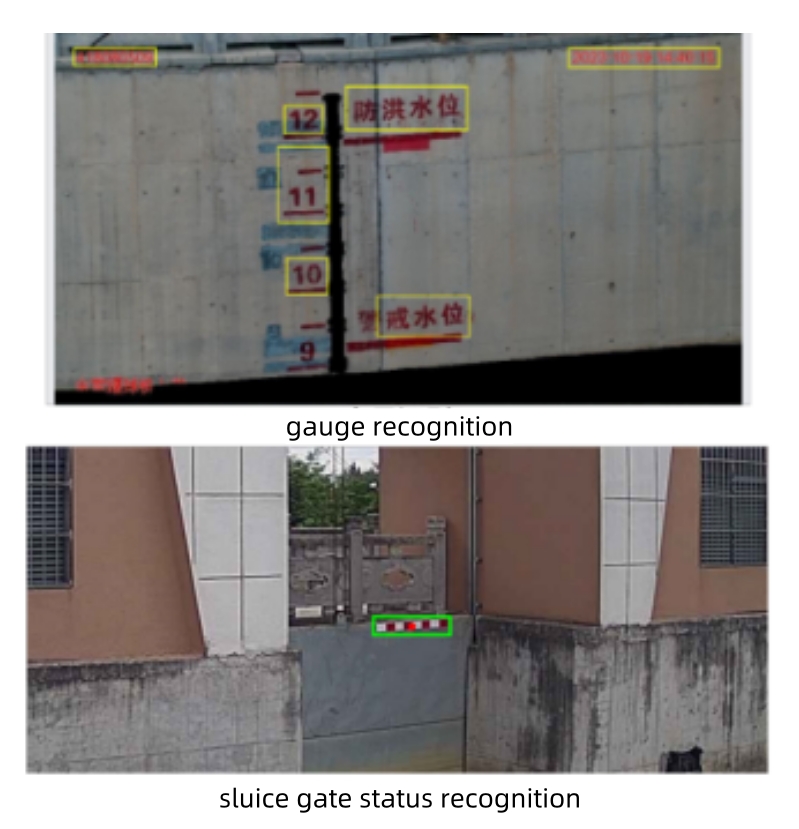
18 Apr,2025Under the impetus of digital transformation, the water conservancy sector is undergoing unprecedented changes. SuperMap actively explores the deep integration of AI technology with digital twin for water conservancy. Leveraging the robust capabilities of ...
15 Apr,2025 AI Water Conservancy digital twin