云&边缘GIS产品 <br/>◇ 全新发布遥感影像处理服务器软件,产品基于Web架构,具备海量数据DOM自动化生产能力及影像智能解译能力,融合云原生技术,可分布式部署,多节点运行,实现计算资源弹性灵活的按需调用<br/>◇ GIS服务器新增支持视频数据快速发布,提供视频数据管理、查询和视频文件推流能力<br/>◇ GIS服务器优化矢量瓦片动态出图性能,16并发下最多可提升35倍<br/>◇ GIS服务器优化大数据量MongoDB瓦片集服务发布性能,发布万级瓦片集后,iServe...
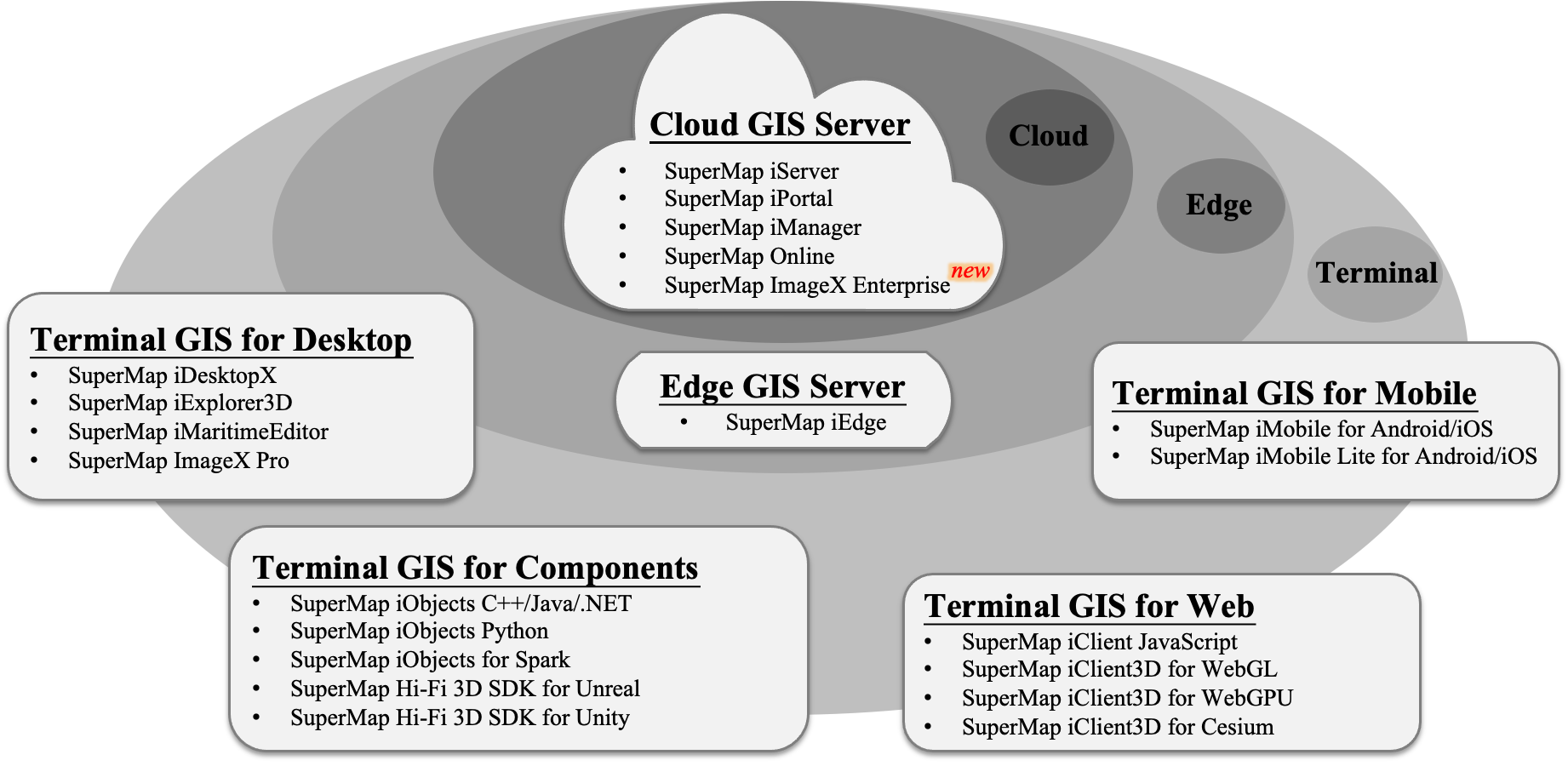
21 Feb,2025SuperMap GIS is a large-scale package of GIS platform software for 2D and 3D integrated spatial data acquisition, storage, management, analysis, processing, mapping and visualization, as well as a development platform for various industries.
21 Feb,2025SuperMap GeoAI Technology Introduction
19 Feb,2025 AI GeoAI SuperMap芯片适配<br/>◇ 支持CPU 架构:X86、ARM、Loongarch、MIPS、SW-64 等<br/>◇ 其中国产 CPU:华为鲲鹏、飞腾、海光、兆芯、龙芯、申威等<br/>◇ 其中国产 GPU:摩尔线程、芯动、象帝先等<br/>--end--<br/>操作系统适配 <br/>◇支持操作系统系列:Linux、Windows、HarmonyOS、 Android、iOS 等<br/>◇其中国产操作系统:银河麒麟、统信 UOS、华为欧拉、中科方德、中科红旗、润和、万里红、...
19 Feb,2025分布式空间数据引擎技术<br/>◇ 支持分布式空间文件系统,包括 HDFS、DSF 等<br/>◇ 支持分布式 SQL 空间数据库,包括阿里 PolarDB、华为 GaussDB、瀚高、达梦、金仓等<br/>◇ 支持分布式 NoSQL 空间数据库,包括 MongoDB、Elasticsearch、HBase 等<br/>--end--<br/>空间区块链技术<br/>◇ 支持区块链空间数据 Fabric 与 IPFS 联合存储<br/>◇ &nbs...
19 Feb,2025AI-enhanced GIS technology enabling smart spatial analysis and customizable AI modeling for cross-industry solutions.
19 Feb,2025A cutting-edge 3D GIS platform integrating real-time spatial analytics, AI-driven modeling, and cross-domain interoperability for dynamic urban and environmental digital twins.
19 Feb,2025The remote sensing technology system integrates advanced photogrammetry and AI-driven LIM, enabling high-performance, cross-platform, cloud-native processing with One High Five Transformations for T+1 efficiency in data-to-product workflows.
19 Feb,2025