Based on Leaflet and SuperMap iClient JavaScript 10i (2020), E-Hualu has developed an integrated green transportation project of the geographic information platform for Yinchuan City.
It is constructed with a modern Web technology stack, integrating leading open source map libraries and visual charts, and provides a display method of brand new big data visualization and data flow functions.
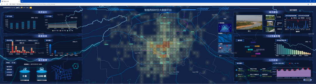
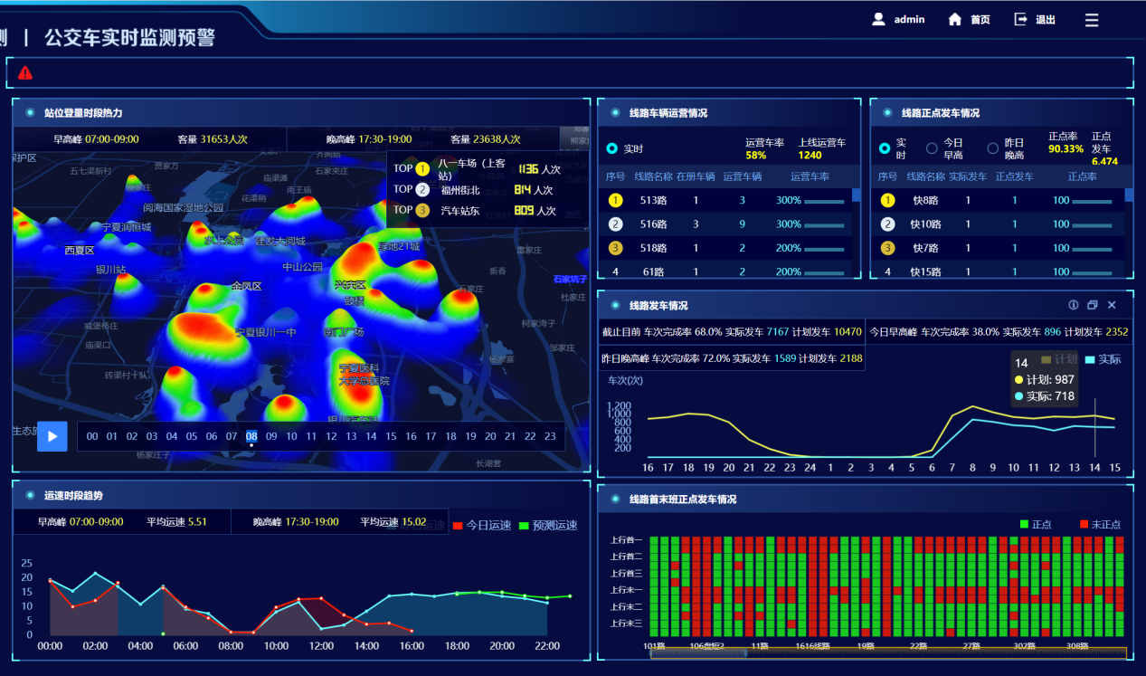
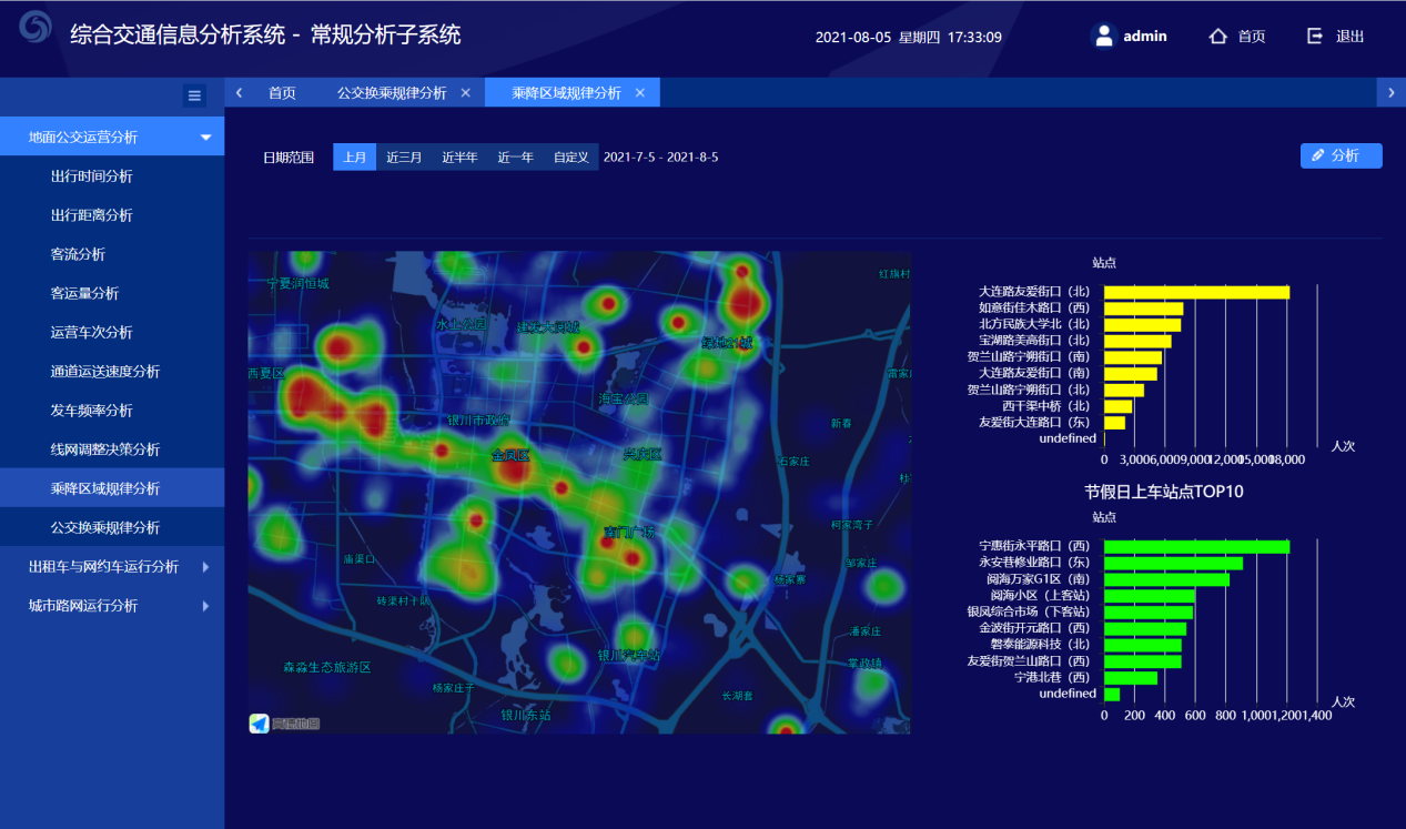
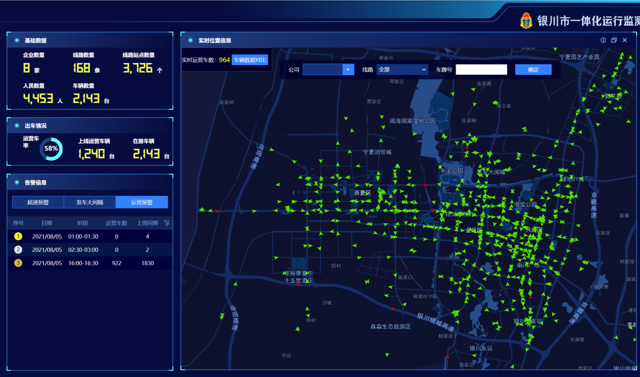
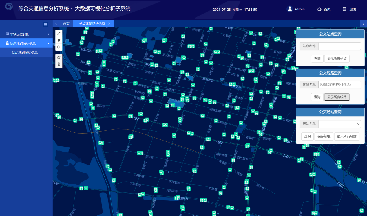
The system displays comprehensive and multi-functional applications like public transport, taxis, and online car-hailing on the Internet map with rich and diverse visual charts, which plays an important role in the decision-making and dispatch of traffic management.
1. Visual display of construction project plans combined with existing data points;
The system collects a large number of point coordinate data according to the real-time operation status of urban public transport and presents the real-time monitoring status (heat map) and real-time operation status (heat map) of public transport under different conditions.
2. echarts visual chart display on the map;
The distribution diagram of urban bus stops (scatterplot), the distribution of real-time buses (scatterplot)
About E-Hualu
Founded in April 2001,Beijing E-Hualu is a listed company controlled by China Hualu Group, a central enterprise under the direct supervision of the State-owned Assets Supervision and Administration Commission of the State Council. The business covers 31 provinces and more than 300 cities in China, and expanded to Asia, Africa and Europe under the promotion of the “the Belt and Road” initiative. E-Hualu implements the “Data Lake +” development strategy, and is committed to promoting the convergence and integration of data production factors in the whole society through the construction of city data lake, which is the digital economic infrastructure in the new era.