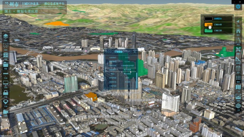
SuperMap and Bolijiang 3D Technology jointly developed a Sand Table and 2D-3D Integrated Information System platform for the central areas of Lanzhou City.
The platform adopts a 3D true-color accurate terrain sand table, IoT, etc., and runs the basic information systems of the city's land, transportation, surveillance video on the physical sand table, and electronic sand table through 2D-3D integration. The system will gradually access more special operation application data in the city, realize the integration of multi-source data, build spatial mathematical models, simulate complex urban systems, perceive urban signs, monitor urban activities, and innovate urban management. It integrates traffic management, video remote monitoring, and remote emergency management and finally forms an auxiliary platform for urban management decision-making, providing urban managers with quantitative tools to conduct urban research.
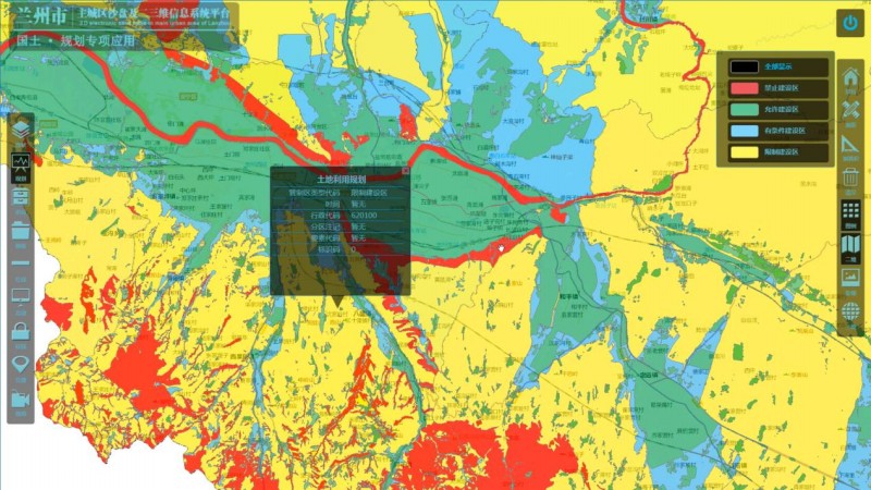
1. "One Map" Platform for Land and Resources
The "One Map" management platform for land and resources integrates multi-source information such as remote sensing images, land use conditions, basic farmland, remote sensing monitoring, mineral resources, geological environment, and basic geography, and integrates with the planning, approval, supply, supplement, development, law enforcement, and other administrative supervision systems are superimposed to jointly build a unified comprehensive supervision platform.
2. Traffic Big Data Public Platform
The system comprehensively integrates the traffic data, geographic information data, and completed traffic information system data of relevant departments and enterprises in the city. A transportation big data platform covering the central areas of the city has been built based on advanced traffic condition processing and integration technologies, which has higher accuracy than some mainstream map platforms on the market.
This system provides the public with road condition information such as traffic conditions, traffic control, and traffic index, and guides citizens to travel conveniently.
Through the mining and analysis of historical data, big data analysis applications such as traffic prediction, traffic index evaluation, and diagnosis are formed to provide a decision-making basis for traffic management departments.
3. Video Integrated Management Platform
The comprehensive video management platform mines the rich value of video images and structures them through intelligent analysis technology, forms a real-time information database, and conducts demonstration applications according to business scenarios. The demonstration application is mainly based on people, cars, and objects in the video images to dig out information about faces, objects, behaviors, and scenes. It has been upgraded in the search for people and objects for the elderly and children accidentally lost, the accidental forgetting and loss of carry-on items, etc., as well as the guidance warning for crowded shopping malls, crowded parks, and other scenes with large crowds.