China Pacific Insurance (Group) Co., Ltd. has established a customer risk management system based on the SuperMap GIS platform.

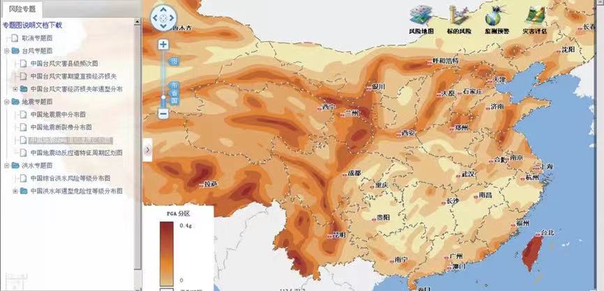
Risk thematic map
With this system, after the front-line risk survey personnel input the information of enterprise risk features, and combine it with disaster risk information of customers, the corporate risk survey reports will be generated automatically.
Also, by digitizing the disaster or loss prevention technology of CPIC, and establishing a risk knowledge library, this system enables data classification and authority-based retrieval and maintenance. It provides remote technical support for front-line risk survey personnel. It builds an active risk investigation service mechanism, which can reduce the risk loss of the underwriting target, optimize the refined management of the property insurance business, and increase the underwriting profit of the CPIC property insurance business.

Rainfall distribution
A natural disaster database to support disaster data query and risk map viewing
This system includes a natural disaster spatial database (typhoon, earthquake, hydrology, meteorology, etc.), provides thematic maps, which can intuitively reflect the disaster risk of a certain location; provides the latest real-time data such as earthquakes, typhoons, rainfall, etc., which are displayed on the map.
Enterprise customer risk management with the risk investigation mechanism
The system focuses on customers, establishes customer risk files, achieves risk management for customers, and establishes a risk survey service mechanism for small and medium-sized customers underwriting before insurance, filling in customer risks, customer photos and customer disaster risk analysis and assessment based on geographic location, which can comprehensively understand the risk of each customer reduce the risk of underwriting.

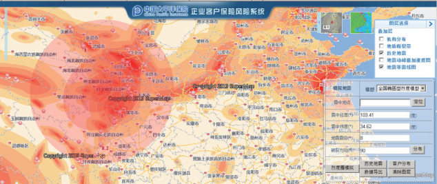
Seismic evaluation
Utilize GIS spatial analysis and introduce disaster models to evaluate disasters
The system utilizes GIS spatial analysis and introduces existing earthquake assessment models and typhoon calculation models, to assess losses caused by historical disasters and new disasters, and form disaster risks analytical assessment reports.