AI Remote Sensing Image Intepretation
1.Workflow of Intelligent Remote Sensing Interpretation
SuperMap supports full-lifecycle AI capabilities for remote sensing.
1) Step 1: Data Preparation
Image Sample Management

Training Data Generation

2) Step 2: Model Construction
Model Training

3) Step 3: Model Application
Model Inference

Post-Processing of Inference Results

2.Product Features: "Out-of-the-Box" Pre-Trained Models
SuperMap provides pre-trained models that are ready to use, addressing the problems of limited samples and difficult training.
Abundant Computational Resources

Large-Scale Base Training Data

3.Traditional AI Remote Sensing Interpretation:
Pre-trained models are ready to use, with new additions such as forest and thick cloud detection

*In the field of intelligent remote sensing interpretation, SuperMap continues to expand its pre-trained models for typical features. In the 2024 version, new pre-trained models for forest and thick cloud detection have been added, ready for immediate use.
Based on trained AI models, clouds of varying sizes and reflectance intensities can be accurately extracted, with an overall pixel accuracy of up to 97.62%.
4. Large Models Empowering AI Remote Sensing Interpretation
1) Expanding the SAM (Segment Anything Model) to enhance intelligent remote sensing interpretation capabilities
Geospatial SAM:G-SAM

2) G-SAM Polygon Prompt Segmentation

3) G-SAM Interactive Prompt Segmentation
4) SAM is Not Specialized Enough; Professional Remote Sensing Interpretation Models are Needed
Feature 1:Self-Supervised Learning

Feature 2: Hundreds of Millions of Parameters

Feature 3: Specialized for Remote Sensing Interpretation

5) SuperMap Remote Sensing Interpretation Large Model—SuperMap LIM (Large Imagery Model)
*SuperMap remote sensing interpretation base model (LIM) can be fine-tuned with various downstream task networks to create large models suitable for different remote sensing tasks.
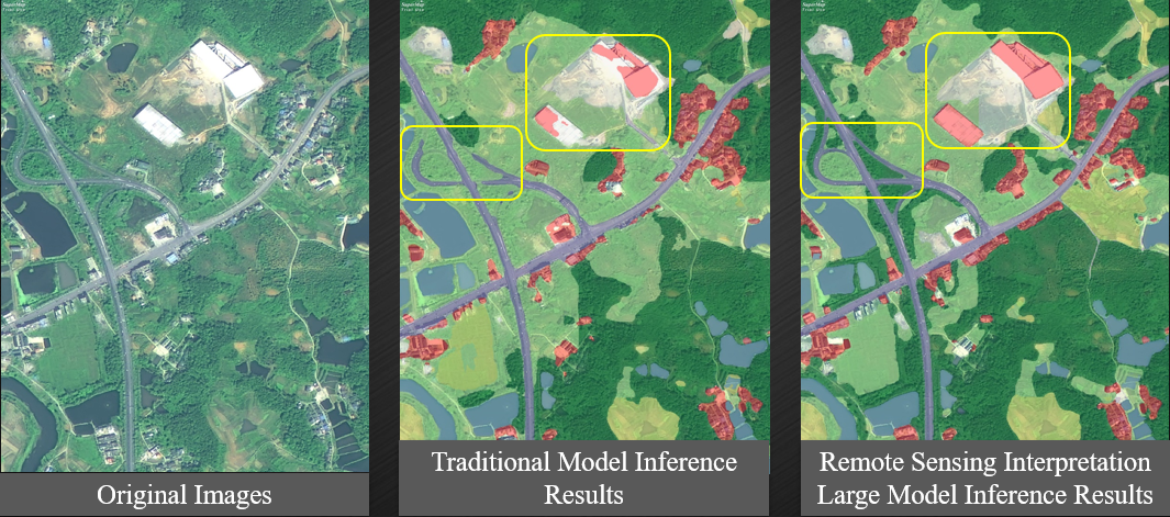
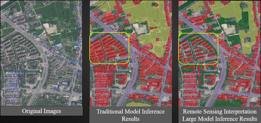
The ground object classification large model supports the extraction of typical objects such as buildings, roads, and water bodies. Compared to traditional models, classification accuracy is significantly improved, and interpretation results are more refined.

6) Remote sensing interpretation large model provide more accurate ground object classification

