Summer is the peak season for fire accidents. To eliminate fire safety hazards, firefighting agencies conduct fire safety hazard inspections in flammable and explosive places, especially the deployment and maintenance of firefighting facilities and equipment, high-risk areas, fire incident sites, firefighting agencies, and the implementation of fire safety responsibilities.
How to combine these investigation data to assist in intelligent decision-making for fire emergency response is a concern of the industry. Dituhui, a sub-brand of SuperMap, launched a fire map solution that visualizes fire information based on geographic big data, allowing "data to speak" and achieving scientific management and auxiliary decision-making for fire emergency response.
Firefighting information visualization
In the fire map solution, users can mark the locations of fire hydrants, water sources, valves, manhole covers, high-risk areas, fire incident sites, and fire agencies on the map, so that the information data and distribution are clear at a glance. At the same time, Dituhui also provides users with a custom icon function, where users can use intuitive icons instead of original icons, making all information clearer and management more intuitive.
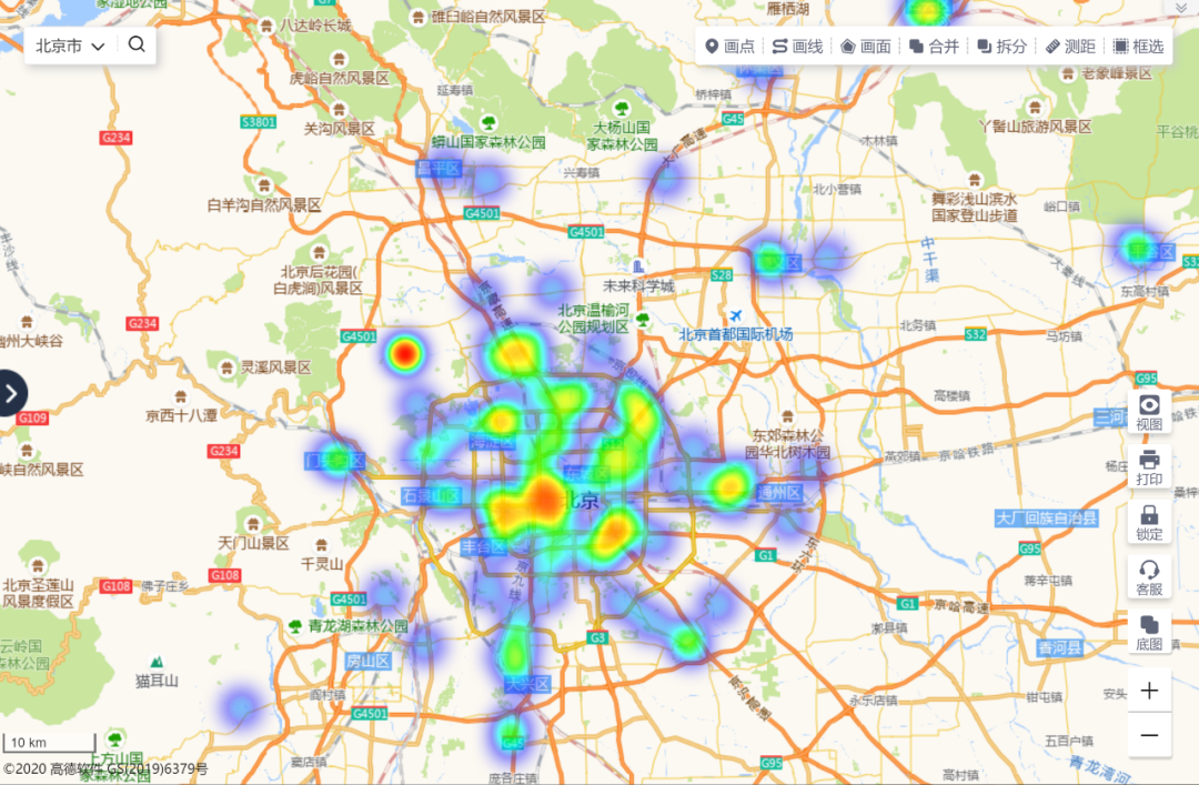
For objects with a large number (such as fire hydrants), users can use heat maps or grid aggregation maps to display them, clearly showing the density of fire hydrants in the city.

Fire hydrant distribution heat map
Fire service area division
Every day, each firefighting organization, such as the fire brigade, fire squadron, and fire station, has its own service scope, which is not intuitive enough to describe with words. In the firefighting map solution, users can draw the areas that firefighting organizations are responsible for, and can see the scope of the places that each fire station is responsible for.
In addition, the fire map solution also provides the function of importing four-level administrative divisions. Units at the fire brigade level only need to import district and county boundaries with one click to quickly display their business scope.
Rapid screening of fire-fighting blank areas
If a city's firefighting equipment is reasonably laid out, the success rate of firefighting and rescue will be greatly improved. If there are firefighting blind spots, once an emergency fire is sent, it may cause serious consequences. How to find firefighting blind spots? We can use buffers to quickly find firefighting blank areas.
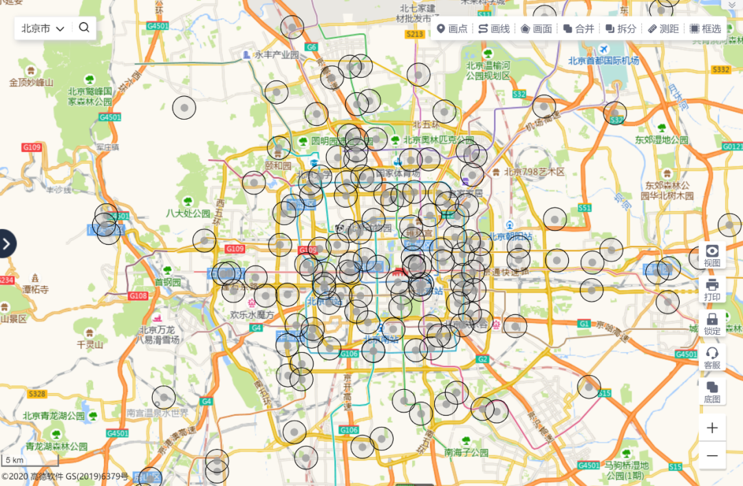
In the fire map solution, users can quickly find fire blank areas by setting buffers. For example, if the 1km coverage area around the valve point is automatically drawn, it is possible to quickly check whether there are fire-blank areas around all valve layouts in the city. Areas with serious buffer overlap will be prompted not to be added to avoid wasting resources.

Valve 1km buffer zone
High-risk area inspection and early warning
The fire map solution can set an "alarm" for patrol warnings. When regularly inspecting high-risk locations, fire inspectors can set patrol warnings in advance on the map.
For example, if some high-risk areas need to be inspected on the 10th of each month, reminder conditions such as one day, three days, or even a week in advance can be set on the map. Each reminder condition can be set with a different flashing icon. When the reminder condition is triggered, a flashing warning will appear on the map, which is convenient for inspectors to handle in time and remind relevant responsible persons to conduct timely inspections.
Reasonable planning of inspection routes
Fire inspectors will inspect fire hydrants from time to time to check their status and whether there are any hidden dangers. Using the map's intelligent route planning function, you can set a reasonable and scientific inspection route: select the fire hydrants that need to be inspected, fill in the number of inspectors, and select the actual inspection transportation.
The system will call the background intelligent route planning algorithm and plan multiple optimal paths (one for each inspector) at the same time so that the overall inspection route is optimal and the time consumption is the shortest. Fire inspectors can use the mobile phone APP to navigate directly, greatly improving inspection efficiency. For high-risk locations with fixed routes that require regular inspections, the route planned along the road can be used to meet the needs.

Fire hydrant inspection route planning on the web
Information collection in high-risk areas
During routine inspections, fire inspectors will discover some locations with potential safety hazards. At this time, they can use MapSmart to collect data on such locations and quickly form a database of high-risk areas.
Through the business flow function of Dituhui, fire inspectors can set up the collection process in advance, such as from the initial data collection, initial inspection, re-inspection to registration completion, to finally determine whether it is a high-risk location and whether regular inspections are required.
For hidden dangers found during the inspection, fire inspectors who cannot make on-site rectifications can instruct them to make rectifications within a time limit and conduct regular inspections. At the same time, they will be educated on fire safety knowledge to enhance the fire safety awareness of enterprises and places and ensure the safety of life and production.
Summary
Over the years, DituHui has been deeply involved in the fire protection industry, deeply understood user needs, and provided map solutions for dozens of fire protection units and institutions across the country. Welcome to experience the DituHui platform and make your fire protection industry data come alive!