To view the first part of the article, please click: https://www.supermap.com/en-us/news/?82_3952.html
Efficient collaboration between multiple users and multiple applications, saving time and effort in large-screen construction
Multi-user real-time collaborative editing capabilities added
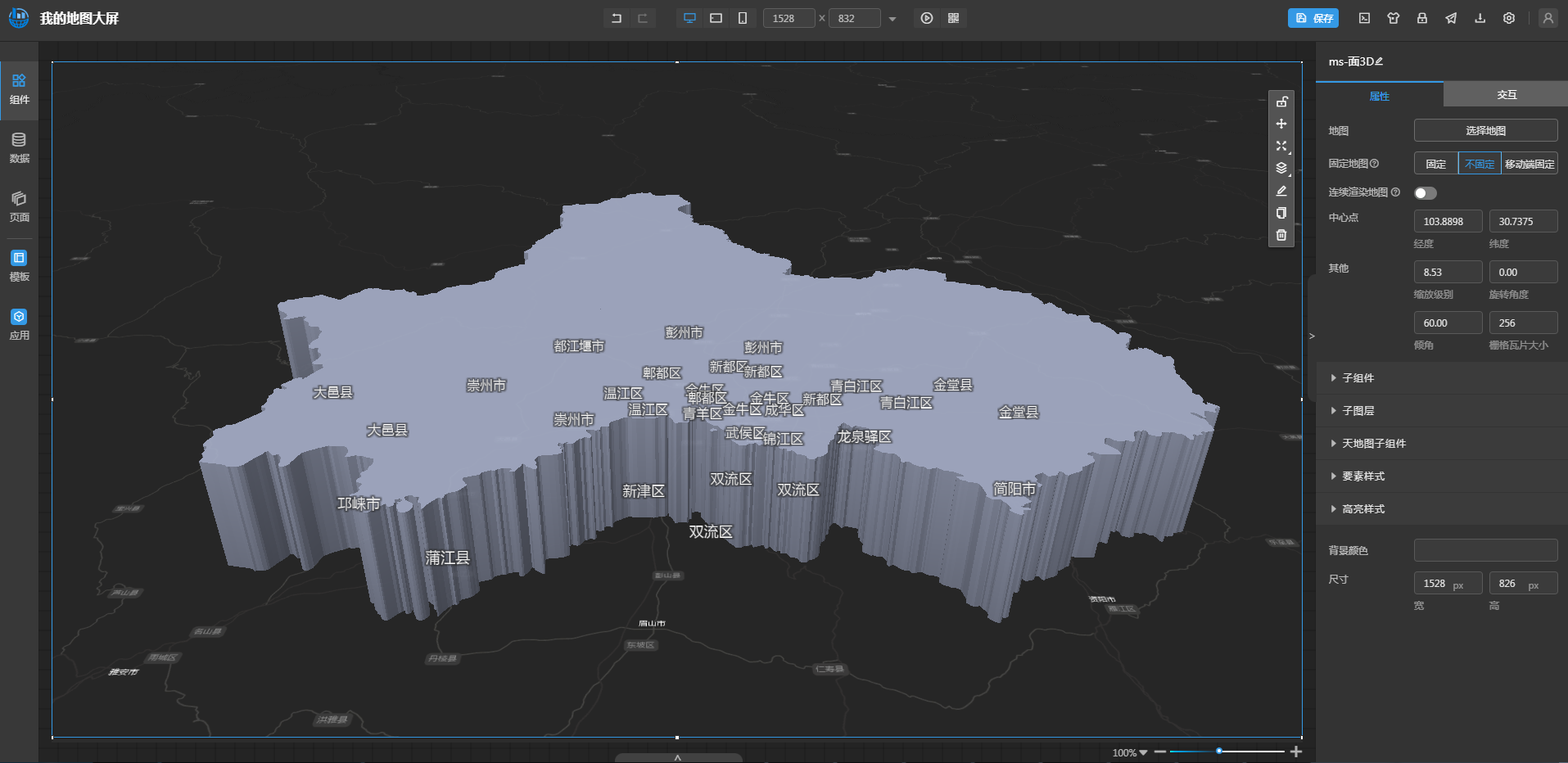
The Map Screen WebApp can easily build an industry visualization screen through a graphical interface and interactive operations. In order to improve the efficiency of creating large-screen applications, the Map Screen now allows multiple users to collaborate in real-time editing, and can directly see each other's changes on the screen, effectively avoiding editing conflicts; it also supports automatic saving of historical versions, which can be viewed and restored at any time, and any modification can be easily traced back.
Seamless access to map studio mapping results
In addition to being able to access the mapping results of the Data Map WebApp, the map screen now supports access to maps made by the Map Studio WebApp, promoting the interconnection of resources between WebApps. Users can directly use professional and beautiful mapping results to display information on the big screen, reducing repetitive mapping work and making the visualization and application of map data simple and efficient.

One-click access to maps made by Map Studio WebApp
Flexible customization of operator parameter UI and facilitate efficient modeling by dragging data
Added custom operator parameter configuration UI
The processing automation modeling WebApp can quickly build business process models by simply dragging and dropping, thereby automating complex data processing and analysis processes. The new version is no longer limited to traditional fixed parameter configuration items, but allows users to freely customize the parameter configuration items of operators according to specific needs or business scenarios. At the same time, it provides complete extended customization development d0cuments and sample codes for reference, which greatly reduces the threshold for customized development.
Participation in modeling operations by dragging data
The new version adds a data directory in the left navigation bar, which displays the data in the portal and its data source and data set list in a clear hierarchical form. Users can directly drag the data source or data set node into the modeling process as a variable to connect with the tool. The advantage is that, on the one hand, the drag-and-drop method replaces the original manual input of parameters, greatly simplifying the parameter configuration process; on the other hand, when the connected tool needs to configure the field, it can automatically identify the data set field for selection, reducing the possibility of field filling errors, thereby improving modeling efficiency.
Convenient 3D geographic design to create realistic models
3D Geographic Design is a lightweight 3D WebApp developed based on SuperMap iClient3D for WebGL. It has the ability to quickly model online and edit with multiple people based on real geographic environments, empowering industries such as urban design and digital transportation.
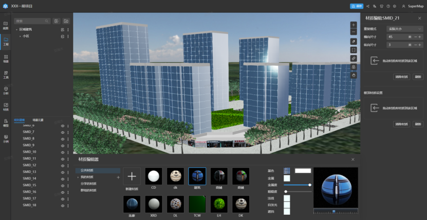
In the new version, the 3D Geographic Design WebApp has added the attribute field lofting model function, enhanced the capabilities of multi-source data access, PBR model material editing, scene element editing and management, and optimized the scene browsing experience. Users can personalize and adjust the model according to actual needs to achieve a more detailed, exquisite, and realistic 3D model effect.

Modeling results support PBR materials, which can express more realistic buildings
In summary, based on the positioning of cloud GIS portal software platform, SuperMap iPortal 2024 has significantly improved in terms of GIS resource management, user management, and built-in WebApps capabilities. In addition to the new features highlighted above, the Map Studio WebApp also provides deeper support for access to multi-coordinate system data and Internet base maps; the Map Large Screen WebApp also improves the browsing of scenes and maps on large screen pages, providing more flexible data components and richer large-screen templates; at the same time, the 3D Earth WebApp also provides 3D scene and video integration capabilities, enhancing data query and display capabilities.
In the future, SuperMap iPortal will continue to improve its capabilities in resource integration, search, sharing and management, continuously enhance the product experience, and provide users with a more professional and easy-to-use cloud GIS portal software platform.