Since the advent of 2D and 3D integration GIS technology in 2011, 3D GIS has officially entered a new stage of development. Since then, driven by the demand for 3D spatial information and the vigorous development of computer technology and data acquisition technology, 3D GIS technology has been more widely developed: its integration with oblique photogrammetry, laser scanning, BIM and other technologies has expanded its application scenario from macro to micro and from outdoor to indoor; the Web3D engine based on WebGL/WebGPU technology does not require any plug-ins or APPs, making it easy to integrate with business systems and better meet users’ business management needs; the combination with XR technology provides a more intuitive visual experience for human-computer interaction; the cross-border integration with game engines has achieved two-way empowerment.
In the wave of digital transformation, 3D GIS technology, as a key technology to solve the problems of storage, management, calculation, analysis, visualization and publishing of massive 3D geographic spatial data, has been widely and deeply applied in the fields of 3D Real Scene, smart cities, digital parks, smart pipe networks, etc. The continuous development of technologies such as digital twins and artificial intelligence, as well as the gradual implementation of digital management of natural resources, digital twin water conservancy, digital housing and construction, have put forward new requirements for 3D GIS technology. 3D GIS technology needs continuous breakthroughs to provide more powerful capabilities such as massive multi-source data management, efficient 3D modeling, and high-fidelity visualization.
01 How can AI+GIS bring greater value?
In terms of the management of multi-source heterogeneous 3D data, a full-process management solution for from access, processing, analysis, service release to multi-terminal applications has already been launched. However, how to achieve efficient processing and rendering of massive data, especially real-time rendering and multi-scale expression of large-scale scenes, is still a technical challenge currently faced by the industry. In addition, how to combine AI technology with 3D GIS to improve data processing efficiency and quality, better explore data value, and achieve efficient management of 3D data?

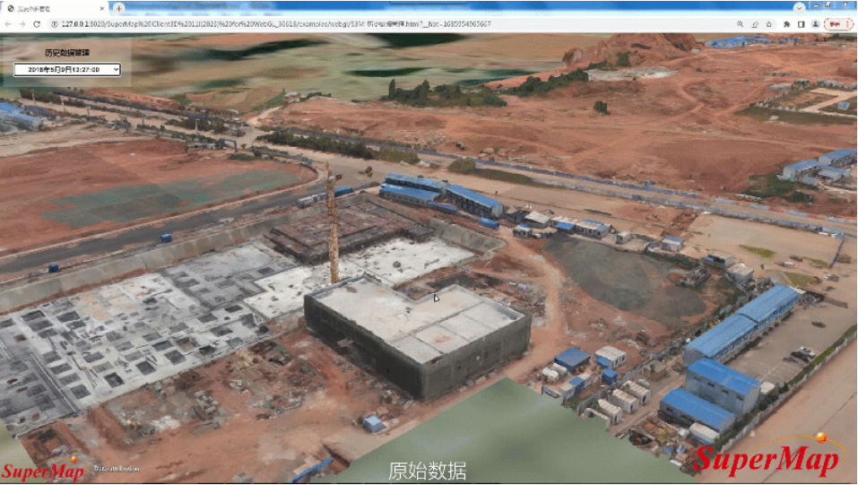
Partial data update of oblique photography 3D model

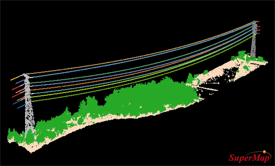
AI-based point cloud instance segmentation


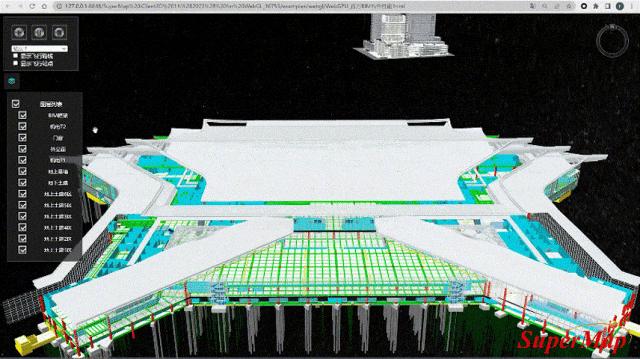
Web3D terminal smoothly displays millions of BIM components
02 How to automatically build a 3D model based on vector data?
In terms of 3D modeling, through symbolic modeling, rule-based modeling and parametric modeling capabilities, large-scale 3D scenes can be quickly built based on vector data. The release of SuperMap iDesigner3D provides users with a new experience of online 3D geographic design and multi-person interactive editing. Despite this, how to automatically build a 3D model based on vector data, especially how to automatically extract features from raw data and build an accurate 3D model, is still a technical challenge. This not only involves complex algorithms, but also relies on the application of AI and machine learning technologies.

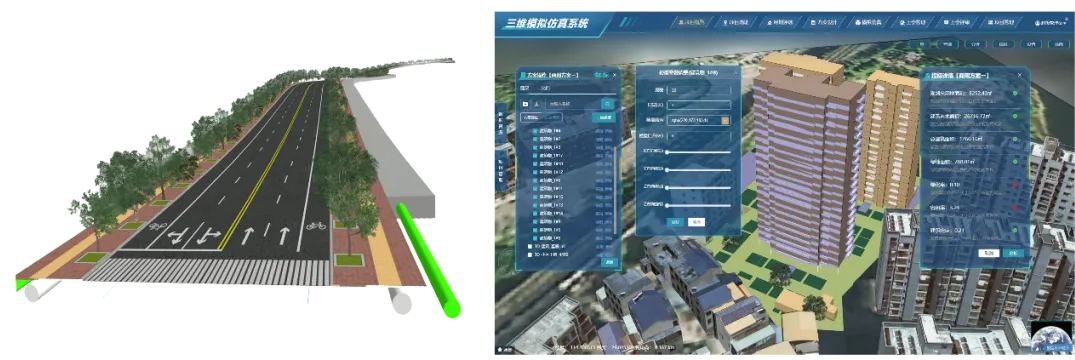
Quickly build urban roads and buildings based on vector data
03 How can the Web3D engine evolve to better meet business needs?
In terms of high-fidelity visualization, the Web3D engine provides visualization effects that are closer to game engines. In addition, the high-fidelity 3D GIS development package that deeply integrates with the game engine closely combines with the spatial data management, spatial query and analysis capabilities of 3D GIS with the high-fidelity scene expression capabilities of game engine. However, as the business continues to develop, how to better meet the needs of natural resources, water conservancy, pipe networks and other fields for data expression, visualization and analysis is worth our consideration.

High-realistic rendering capabilities of Web3D engines

3D GIS and game engine cross-border integration to create highly realistic 3D scenes

3D GIS and game engine cross-border integration to achieve GIS analysis based on UE model assets
The 2024 Geospatial Intelligence Software Technology Conference will be held at the China National Convention Center from June 25 to 26, 2024. The conference will not only answer the above questions or doubts about 3D GIS, but also showcase more geospatial intelligence software technology and product progress. We sincerely invite you to be present to exchange the latest progress of 3D GIS technology. Welcome to view the website to register for the conference!
