To view the first part of the introduction, please click here.
Clear at a glance: more expressions
Thematic maps use visual elements such as map symbols and colors to express thematic information. It presents complex data and information in an intuitive and vivid way. It is a data visualization tool for displaying specific geographic information and helps users better understand relevant information and improve the efficiency of information transmission. The new version of the AR map can not only make users browse thematic maps at any time in the real scene in the form of a sandbox, but also achieves position and direction matching. By placing thematic maps 1:1 in real scenes, users can grasp geographic information at a glance in real scenes and use and analyze geographic information in actual environments. In precision agriculture applications, the new version of the AR map will include real-time environmental data such as crop growth status data, temperature, humidity, and lighting, and match them one by one to real farmland plots. By regularly refreshing the sensor data of the corresponding plots, it is convenient for users to understand the crop information and environmental data of each plot, so as to detect and deal with abnormal situations in a timely manner and ensure the healthy growth of crops. This not only helps improve agricultural production efficiency, but also helps increase crop yields and provides strong support for farmland management, scientific planting and agricultural planning.
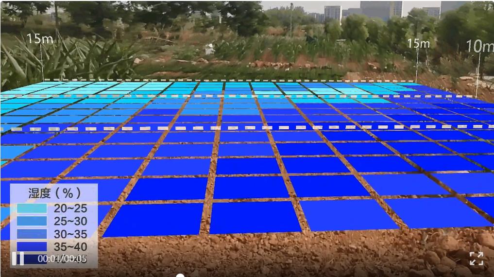
Precision agriculture thematic map
Diverse formats: more map types
AR maps support placing maps, videos, etc. in real scenes, enriching its application scenarios. The AR map format of the new version has been further expanded, adding the ability to directly load xml and kml format maps into real scenes. At the same time, the video format has been expanded, and the video data set produced by SuperMap iDesktop can be loaded directly on the mobile terminal.
AR maps are profoundly changing the way we live and work by providing richer and more intuitive geographic information, helping us better understand and adapt to the world. With the development of 5G, Internet of Things and other technologies, AR maps will be integrated with more devices and services, further broadening their application fields. SuperMap will continue to optimize and upgrade AR maps in response to technological development and practical application needs. We look forward to AR maps playing a greater role in the future and bringing more convenience and fun to our lives.
End.


