The City Information Model (CIM) basic platform (hereinafter referred to as the " CIM platform"), as an important support for the construction of digital twin cities, is a basic operation platform that manages and expresses 3D digital models such as urban 3D space, buildings and infrastructure, and supports urban planning and construction, management, and operation. It is a fundamental information infrastructure of smart cities.
BIM, which can be understood as Building Information Modeling or Building Information Management, is a 3D building model established based on various relevant information data of construction projects, widely used in the architectural design and construction process. Compared with 3ds Max model data, BIM model data is more detailed and accurate, and has complete semantic and attribute information, which can meet the needs of refined management in CIM+ applications. In addition, the BIM model data topology is more complete and more suitable for spatial query and spatial analysis. Thus, it is an important data source for the CIM platform.
The SuperMap CIM platform adopts BIM+GIS technology, achieving breakthroughs in key technologies such as lossless access to BIM mainstream data, seamless connection between BIM data and three-dimensional (3D) models, and real-time rendering of over one million BIM models. It realizes a complete closed loop from BIM data access, processing, rendering to analysis and result output. It is oriented to scenarios and spaces at different levels such as cities, parks, communities, buildings, etc., and supports spatial governance applications with full-space coverage, full-cycle management and control, and full business collaboration, effectively improving urban spatial governance capabilities.
BIM data access
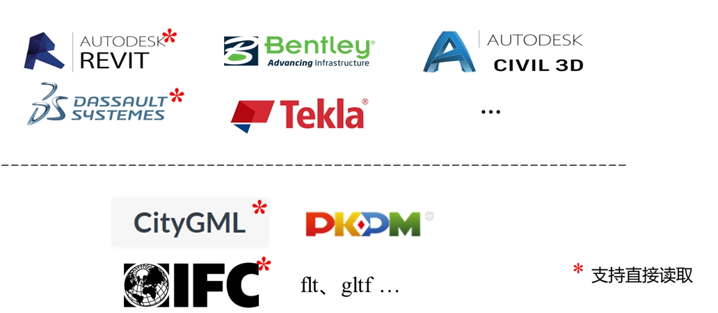
There are plenty of BIM software in the world, with different file formats. In order to ensure lossless access to BIM data, SuperMap GIS products provide data export plug-ins for BIM design software such as Bentley, AUTODESK CIVIL 3D, Tekla, etc., and import them into SuperMap products; at the same time, SuperMap GIS supports docking of exchange format IFC. By deepening strategic cooperation with BIM-related companies, it supports the direct opening of Revit, CATIA, CityGML and other data as data sources, thus achieving a seamless connection between BIM and GIS data.
BIM supported by SuperMap GIS
BIM data processing and management
Model editing
SuperMap GIS product can not only edit the geometric information and attribute information of BIM objects, but also edit a sub-object of the BIM object, such as: texture replacement of sub-objects, tone adjustment of textures, etc. It also supports exporting to OSGB, S3M, GLTIF, STL, OFF, DAE and other data formats.
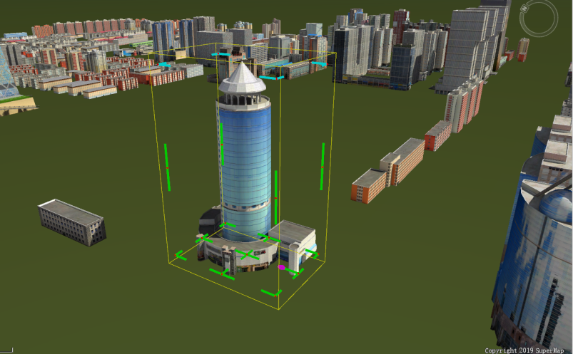
Besides, to help users to edit the BIM model location more conveniently, SuperMap GIS products provide a batch editing function for model data sets, which can perform operations such as translation and rotation of the entire data set layer.
Model editing
Group management
SuperMap GIS products support custom grouping of BIM layers, and you can quickly view one or more types of model data through layer switches.
Model cropping
SuperMap GIS products support model cropping, mainly including plane cropping, Cross cropping, BOX cropping and specified object cropping, empowering the CIM platform to implement cropping of urban information models.
1. Plane cropping: Plane cropping realizes cropping of the model by drawing a plane and only displaying the scene on one side of the plane .
2. Cross cropping: Quadrilateral cropping. By drawing a quadrilateral and cropping out the data within the range of the quadrilateral, you can view the internal conditions of the model. It supports horizontal, vertical, and rotation.
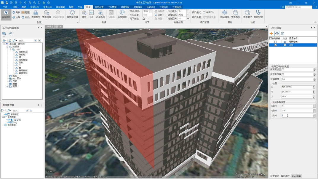
Cross cropping
3. BOX cropping: It refers to cropping the specified object model through the set Box area (a cuboid with a certain length, width, and height) to display the scene inside or outside the Box area. In addition, Box cropping only decides whether the model and other data in the scene is displayed in or outside the Box area, and does not perform actual cropping operations on the object.
Using Box cropping, you can directly view the inside of the model without entering the into it. For example, if you set a local Box cropping area for the National Stadium (Bird's Nest) model, the effect will be as shown in the figure below.
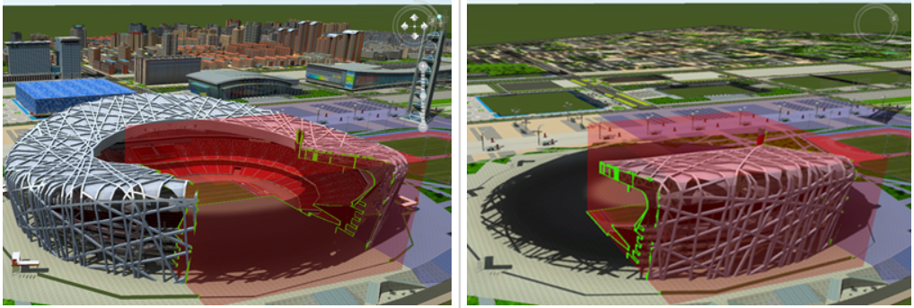
BOX cutting
4. Cropping of specified objects: SuperMap GIS product supports cropping of specified objects and performs cropping and filtering based on the model ID, thus realize cropping of specified objects in the precision model cache.
Model segmentation
SuperMap GIS product supports model segmentation function, and setting the number of segments. The selected or all model objects can be segmented into multiple objects.
Dynamic simulation
Dynamic simulation refers to providing dynamic simulation functions by setting the display and hiding of BIM models. In practical applications, it is possible to simulate the building construction process, and view construction production conditions, etc.
Manifold correction
It is to correct model objects with topological errors, and the corrected model objects conform to the Halfedge data structure. When a model is not closed, problems such as inability to section or inability to perform Boolean operations may occur, so the model needs to be normalized through manifold correction.
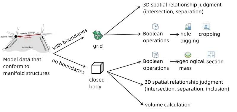
Data model that conforms to manifold structure
To Be Continued...


