The "Four-Type Airport" focuses on safety, green development, intelligence and humanity. Through all-round optimization in the whole process, and all elements, it achieves safe operation, sophisticated and intelligent production management, convenient and efficient passenger travel, and a green and harmonious environment and ecology, fully embodying the high-quality development requirements in the new era.
In recent years, GIS technology has become standard in airport construction and operation: intelligent construction is realized through BIM+GIS during the construction process, and intelligent operation is realized through GIS+IoT technology in the following airport operation to meet the requirement of safe and green construction while focuses on intelligence and humanity.
Recently, the Fuzhou-Xiamen Airport Geographic Information Platform (referred to as "GIS Platform") project constructed by SuperMap was successfully put into operation, ensuring the efficiency of the new construction projects of Fuzhou and Xiamen airports, and accelerating the informatization process of the two airports, making it a scientific and efficient management tool for building smart airports.
01. Unified data standards to build a smart airport
The smart airport geographic information platform is developed and built based on the SuperMap GIS platform, integrating many key technologies such as the Internet of Things, BIM, high-precision positioning, 2D and 3D integration, and GEO-ESB.
The platform is based on the core business of airport engineering management and asset facilities and equipment operation management. Based on the integration of airport engineering drawings and geographical information data, the platform adopts a "2+1+N" framework structure to build an airport engineering geographic database, and the database of airport engineering drawings and archives, and has also built a standard data processing platform for data collection, sorting, database building and management.
By unified management of geographic information data, the platform improves the accuracy of geographic information data, and realizes unified geographic information and spatial information resource sharing services, making different geographic information data connected with each other.
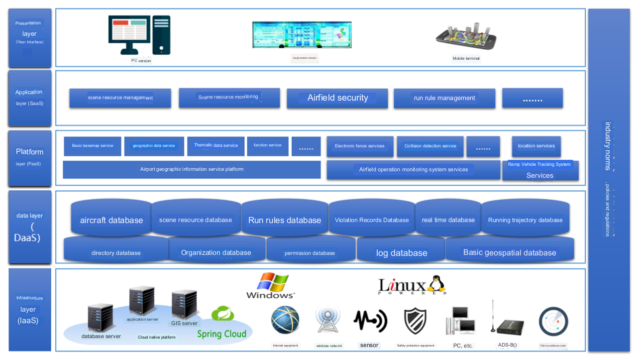
Smart airport geographic information platform service architecture diagram
02. Promoting multi-source integration and empower efficient command
The flight area operation monitoring system built by the platform has already integrated with A-CDM and ADS-B data. It will be connected to field monitoring radar, primary and secondary radar and other systems for aggregation and fusion, and combined with vehicle-mounted Beidou positioning, high-precision maps, video surveillance, weather monitoring, flight dynamics and other data to create a "one map" mode for airport operation command, realizing the display of dynamic object monitoring in the air and on the ground at the airport in real time.
By connecting with various application systems of the airport, using big data analysis and summarization, platform-based management is finally realized. It will provide support for the improvement of flight area operation order and management, comprehensively improve the refinement, automation, and intelligent management and control of the flight area business process, realizing the innovation of the flight area management model, and empowering the command and airport operation.
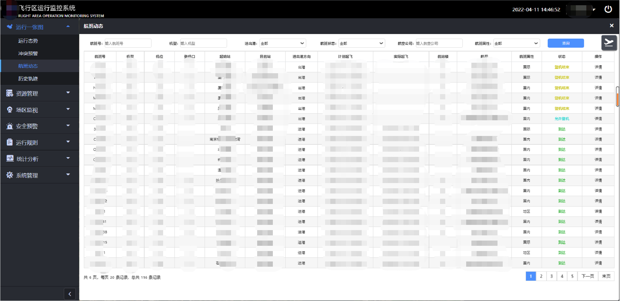
Flight status information
03. Improvement in management and control capabilities for a safe airport
The apron vehicle tracking system built by the platform comprehensively utilizes Beidou + GPS high-precision positioning technology, high-precision map technology, position difference technology, 4G/5G wireless communication and other technologies to provide users with a new, transparent, visible, real-time, interactive, visualized vehicle operation management service.
The system can monitor vehicle speed limits, height limits, prohibited driving and other rules, analyze and judge vehicle violations, remind managers to take relevant actions, so as to enhance the perception of the apron operating environment, and standardize driver’s operation behaviors. This will help make sure the apron vehicles can run safely and efficiently, reduce the accident rate, improve the management and control capabilities of the apron, and create a safe airport.
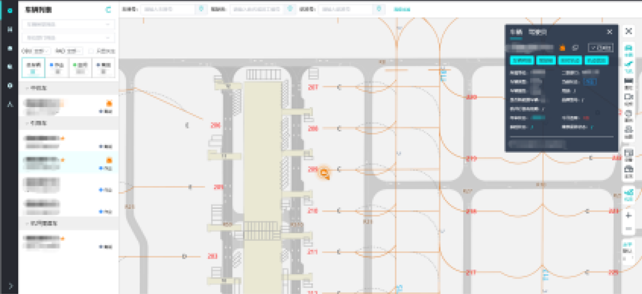
Apron operation "one map"
As an application end for vehicle operation violation warnings, route navigation and other functions, the vehicle-mounted Pad can serve as the driver's "little assistant" during driving through voice reminders of height limits, speed limits, dangerous approaches and other information ahead, providing quick parking space search, route navigation and other functions.
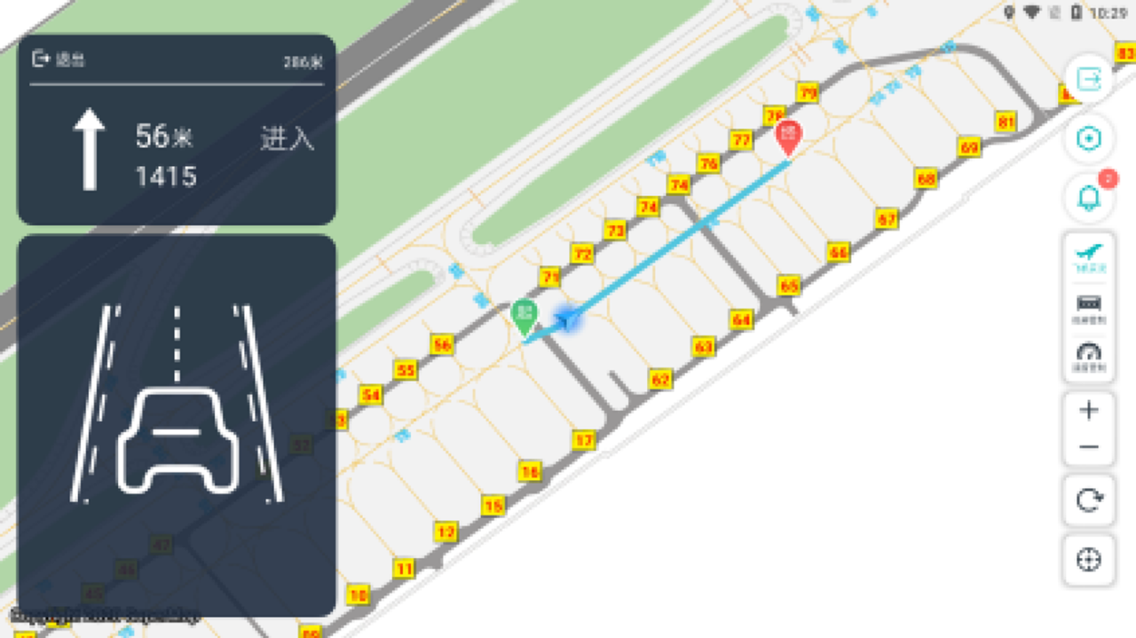
Car pad navigation interface
04. Intelligent pipe network maintenance to achieve precise management
The comprehensive pipeline network management system built on the platform uses geographic information, database technology, image processing technology and visualization technology to visually display the spatial level and location of underground pipelines, and to visually display the buried depth, material, shape, direction and surrounding environment of underground pipelines.
In order to meet the precise management needs of pipelines, the pipeline inspection APP will be launched later, which can realize pipeline inspection, maintenance, abnormal status reporting, dispatch and maintenance, closed-loop verification and other management processes through mobile devices, and realize the integrated and intelligent above-ground and underground precise management.
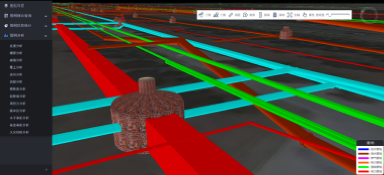
Integrated pipe network management system interface
The construction of the airport geographical information platform provides the airport with a unified geographical information management tool and a geographical information base, enabling visualized construction and operation of the new airport. The capabilities of the GIS platform can be used to support the construction of a VR immersive experience system, allowing airports to make good use of geographic information data.


