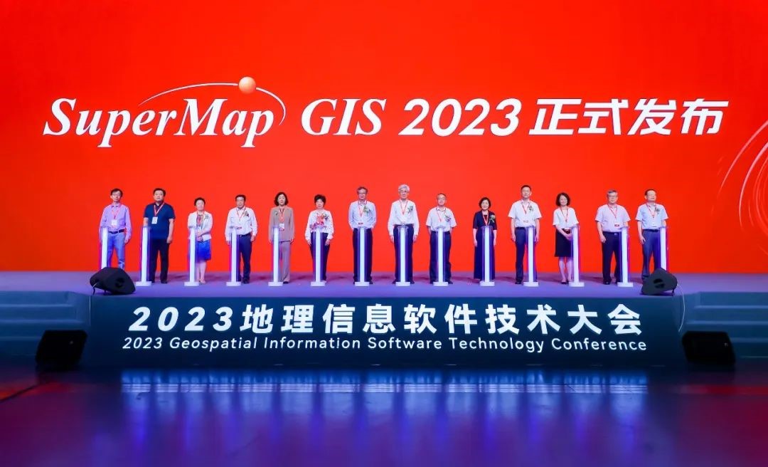
At the plenary conference of the 2023 Geospatial Information Software Technology Conference held on June 27, SuperMap officially released the latest version of SuperMap GIS series products - SuperMap GIS 2023. Apart from having updated the current products, SuperMap also released a number of new products, including cross-platform remote sensing image processing desktop software[ SuperMap ImageX Pro (Beta)], cross-platform electronic nautical chart production desktop software ( SuperMap iMaritimeEditor ), Web-side 3D geographic design software ( SuperMap iDesigner3D), 3D WebGPU client [ SuperMap iClient3D for WebGPU (Beta)] and so on. This article will reveal the features and value of several newly released products in SuperMap GIS 2023.
Features of Newly Released Products in SuperMap GIS 2023
1. Cross-platform remote sensing image processing desktop software——SuperMap ImageX Pro (Beta)
Remote sensing is closely related to GIS, but for a long period of time, the two kinds of software were disconnected with each other. In the process from remote sensing image processing to its application, the processing is carried out in remote sensing software, but data management, data release, and data application all require GIS software. Data conversion takes time and switching between software is laborious. Therefore, the market urgently needs remote sensing GIS and integration.
By fusing with the world's leading photogrammetry and remote sensing core algorithms, and based on intelligence, automation, high-performance computing and other technologies, SuperMap developed the cross-platform remote sensing image processing desktop software - SuperMap ImageX Pro (Beta) to handle the processing of satellite remote sensing image data. It provides more than 60 kinds of remote sensing image processing operators including connection points and ground control points generation, block adjustment, orthorectification, image fusion, etc., capable of using multi-source satellite remote sensing images to produce DOM and DSM /DEM data products.
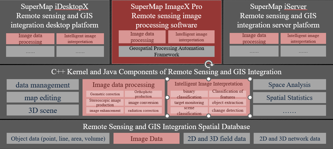
Figure 1: SuperMap Remote Sensing and GIS Integration Product System
SuperMap ImageX Pro (Beta) is built on the basis of remote sensing and GIS integration technology, and features remote sensing and GIS integration, cross-platform, intelligent processing, and high computing performance. The integration of remote sensing and GIS can accelerate the application process of transforming data into geospatial intelligence; being able to be applied to multiple platforms realizes high processing performance, making information more secure; processing intelligence refers to improving the geometric accuracy of image processing and digital surface models' quality, realizing automatic processing to reduce manual intervention; at the same time, it also shortens the data processing time, improves computing performance, and realizes efficient production and application of remote sensing image data.
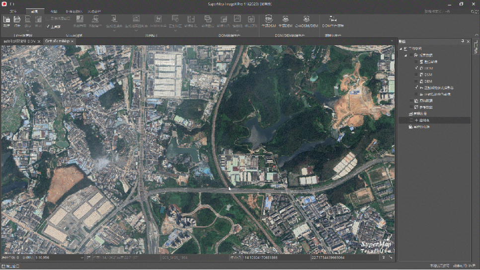
Figure 2: SuperMap ImageX Pro Automated Process
2. Cross-platform electronic nautical chart production desktop software: SuperMap iMaritime Editor
Electronic nautical charts and channel charts provide fundamental data for ship navigation and are essential tools to ensure the safety. In SuperMap GIS 2023, a new cross-platform electronic nautical chart production desktop software ——SuperMap iMaritimeEditor is released. It provides functions such as S57 nautical chart data management, S52 nautical chart display, S58 data inspection, and standard expansion. It is used for the production, application, printing and publication of inland river, port, and coastal charts, and military standard nautical charts, providing technical support for marine survey and mapping, and assisting with comprehensive marine management and decision-making.
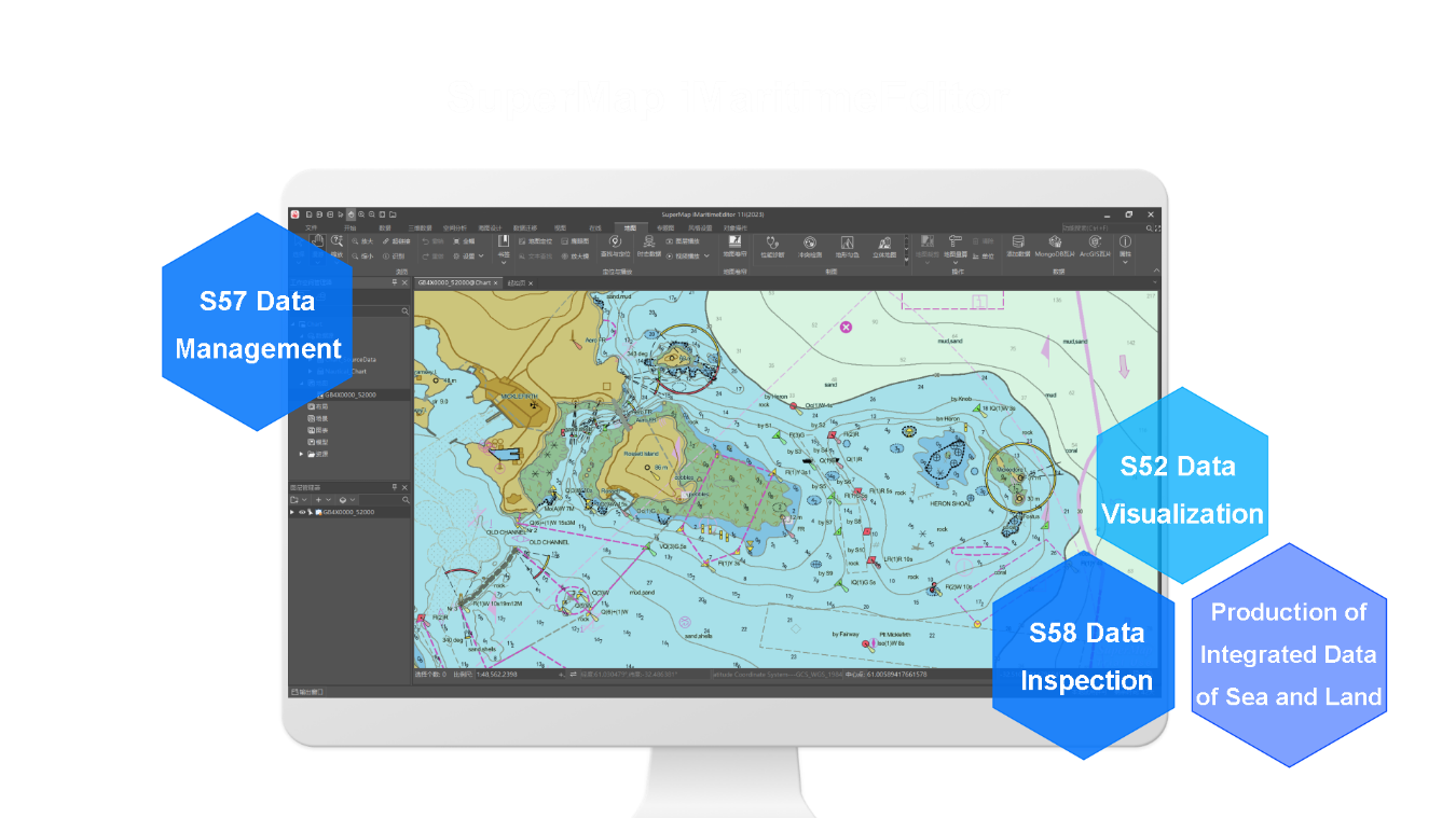
Figure 3: Cross-Platform Nautical Chart Production
3. Web-side 3D geographic design application——SuperMap iDesigner3D
With the in-depth application of 3D geographic design in urban design, road design, water conservancy design and other industries, as well as the rapid development of Internet technology, users gradually put forward the demand for online design and interactive editing. To this end, SuperMap released a new web-side 3D geographic design application: SuperMap iDesigner3D. It is a lightweight WebApp developed based on SuperMap iClient3D for WebGL, deployed on SuperMap iPortal, the portal software platform. And it does not require professional design environment.
In order to meet the online 3D geographic design capabilities, SuperMap iDesigner3D not only provides online batch modeling capabilities based on real geographic environments, but also enables users to batch build 3D models of buildings, roads, and roadways that match the geospatial environment based on vector data and modeling rules. It supports editing and modification of modeling parameters and materials, and can update the editing results online in real time, which can effectively improve the efficiency of data editing.
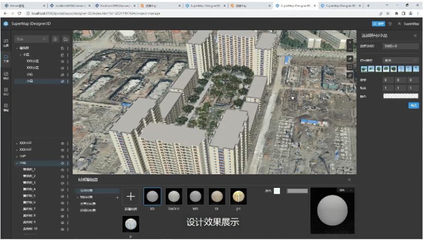
Figure 4: Building and Editing Models Online
To meet the needs of multi-person cross-region interactive editing, SuperMap iDesigner3D supports fast saving, sharing, reviewing and re-editing of modeling results and online assets, which can effectively enhance team collaboration, reduce operation and maintenance costs, and support multi-person cross-region collaborative design and efficient management of design schemes, enabling real-time discussion of schemes, timely communication on issues, efficient sharing of assets, etc.
4.3D WebGPU client——SuperMap iClient3D for WebGPU (Beta)
With the in-depth application of Web3D engine in smart parks, smart cities, and 3D images of natural resources, users have higher requirements for its visualization effect and rendering performance. Moreover, the introduction of WebGPU technology enables better use of GPU hardware on the Web side, providing powerful computing and rendering capabilities.
Driven by market demand and Web technology, SuperMap launched a new 3D WebGPU client: SuperMap iClient3D for WebGPU (Beta). It is a 3D GIS network client development platform based on WebGPU technology, which supports access to multi-source spatial data, more realistic 3D scene, powerful massive data carrying capacity, and rich 3D spatial analysis and query functions. It can effectively support the efficient construction of real 3D China, CIM, digital China and other business systems.

Figure 5: GPU-based Intervisibility Analysis
In addition, SuperMap GIS 2023 also supports both WebGL and WebGPU rendering frameworks from the bottom layer, which can realize the switching between 3D WebGL client and 3D WebGPU client with one click, reducing the cost of data migration. SuperMap GIS 2023 also enhances the capabilities of cloud GIS server, edge GIS server, terminal GIS and other products, and further improves the five technical systems (BitDC) of GIS platform software, namely big data GIS, artificial intelligence GIS, 3D GIS, distributed GIS and cross-platform GIS technology system, providing better support for the informatization of various industries.


