At present, LowCode (Low Code) is extremely popular. It features "visual configuration", "liberation of IT productivity", "low threshold" and "quick response", which constantly knock on the hearts of customers, leading software development to a new world, but under the tide, people can't help thinking: what can LowCode bring to GIS?
The most common thing is the LowCode + WorkFlow (process form) code, which is a general type driven by business, such as an OA system, or a small program for ordering goods and questionnaires. Part of the markets under this model has already undergone fierce competition.
The LowCode + GIS mode is mostly presented in the form of various map in large screens and digital twins. It packages various 2D and 3D capabilities into components, and further display with low-code visualization effects. At present, the competition in this part of the market is also close to white-hot.
So, what kind of solution will be formed if LowCode, GIS, and WorkFlow are added together? What value can it bring to users?
LowCode +GIS+?
Before introducing the SuperMap GIS application building platform (LowCode + GIS + WorkFlow), let's first think about a question - what are the GIS applications? "One map", space-time cloud platform, land use approval, land law enforcement supervision... There are countless applications involving spatial data. If these GIS applications are further classified, two categories can be obtained: spatial data management applications and process-driven applications.
We won’t go into details about the former as SuperMap GIS Application Framework (SuperMap GAF for short) has given a solution for this type. So, can process-driven applications, such as construction land approval, be completed through LowCode+GIS+WorkFlow?
The answer is yes. This type of process-related application often means that changes may be more frequent. With the adjustment of the organizational structure, the entire business process will undergo major changes, and low-code can just meet this demand, changing the approval nodes by dragging and dropping and configuring various business forms.
But apparently this is not enough. Using general models such as LowCode + WorkFlow can only solve part of the problem, and the functions of vertical fields still need GIS to complete. For example, map display, spatial analysis, and result output are required in the approval process, all of which are inseparable from GIS. This is the difference between the SuperMap GIS application building platform (LowCode + GIS + WorkFlow) and general low-code or visual low-code - strong GIS empowerment.
LowCode +GIS+ WorkFlow
In order to better empower users and realize low-code construction of strong GIS approval business, SuperMap has launched a GIS application construction platform (LowCode + GIS + WorkFlow).
The platform is composed of page designer, form designer, process designer, service designer, configurator of support function, and platform manager. It allows developers to build front-end pages by dragging and dropping components and design the back-end interface by operator configuration. With built-in process and form functions, it can quickly transform business requirements into system applications, achieve the purpose of building blocks, logic visualization, business processes, and batch applications, which will ultimately lower the development threshold and help enterprises reduce costs and increase efficiency.
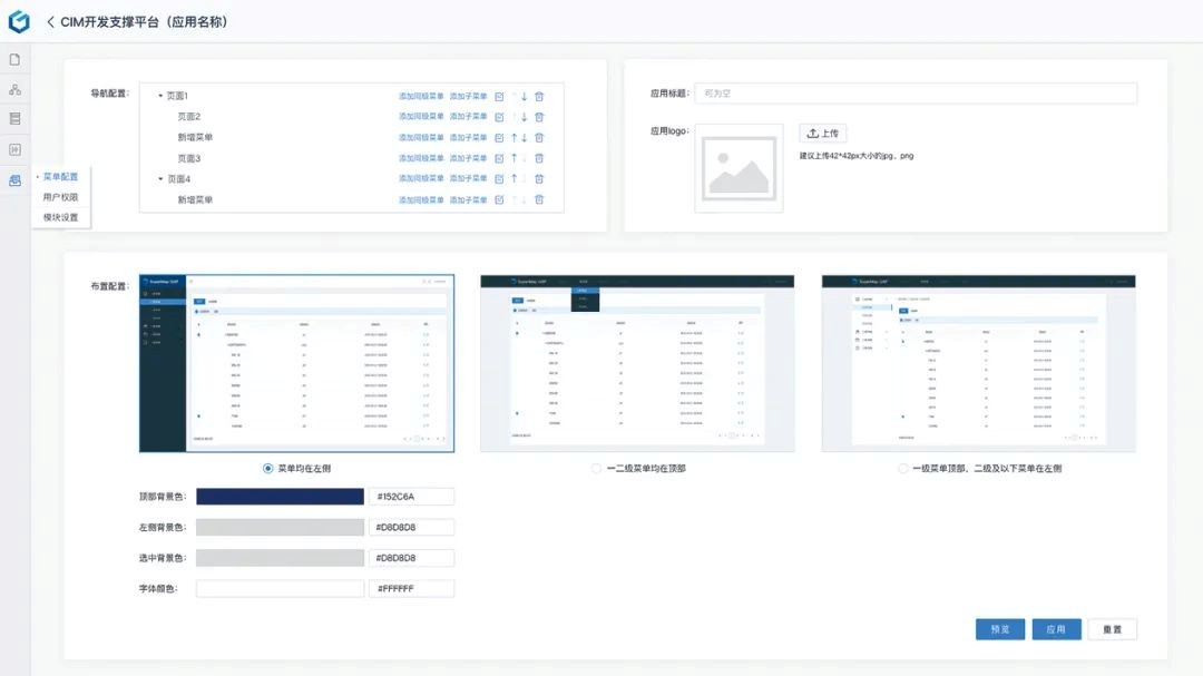
Page Designer: It abandons the traditional development mode, and completes the construction of the front-end page by dragging and dropping components and setting attribute parameters. For example, components such as text, pictures, and buttons can be placed in appropriate positions, and the styles can be adjusted to realize the "viewable" effect of the entire page.
Form designer: drawing on the common form design experience in the natural resources field, you can customize common form components such as forms, input boxes, and drop-down boxes. The designer also provides functions such as downloading and printing, forming a channel for rapid business design.
Process designer: cooperate with the form designer to complete the business flow in the form of a visual process. For example, in the approval of construction land, the flow of the content to be approved can be controlled according to the role of the department, and the operation authority of each node can be controlled.
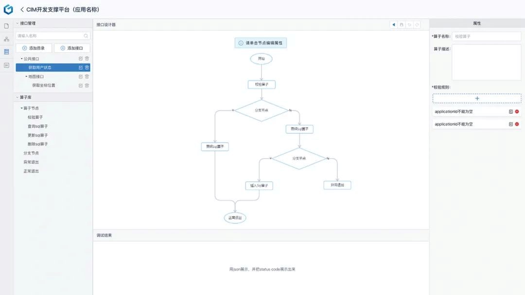
Service Designer: It can access data sources and various map services, 3D services, etc. In addition, the design of the back-end interface can also be completed through the connection of operator nodes, such as querying a certain field of a table and displaying it on the front-end.
Supporting function configurator: it configures the necessary functional modules for the application to run, such as user permissions, which can be directly configured and added.
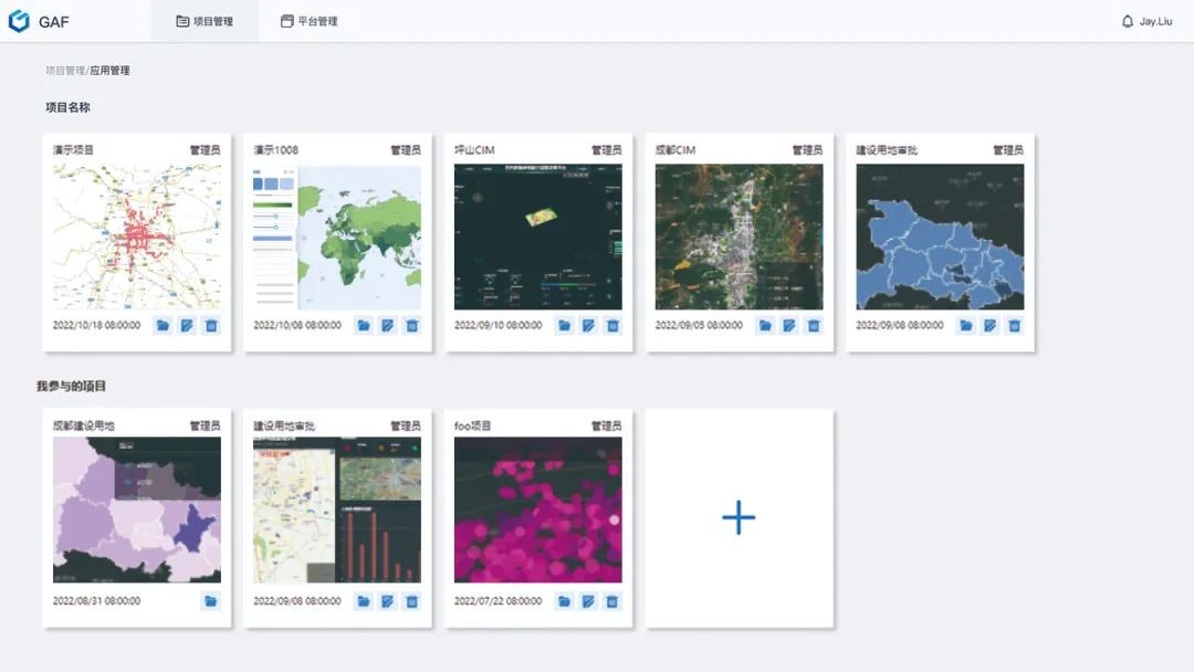
Platform manager: it supports the operation of the low-code platform, and manages projects, applications, and platform users.