SuperMap GIS 11i(2022) was launched at the 5th GIS Software Technology Conference. Supported by numerous brand-new technologies, SuperMap GIS 11i(2022) has multiple upgrades such as multi-source video spatialization based on bigdata GIS and AI GIS, four new features of 3D GIS, Cloud-Native GIS 2.0 of distributed GIS, and open-source spatial database Yukon. In this article, we will discuss its main new features, including Yukon Database, Cloud Native GIS 2.0, More Realistic and Faster 3D Rendering, Advances in SuperMap Desktop and Mobile Products, Cross Platform Mapping and Migration Technology, and WebGIS Low-Code Development Technology.
Yukon Database
SuperMap Yukon Open-source Spatial Database, based on Huawei’s open-source database- openGauss, supports the storage, computing, and management of spatial data.
Yukon is compatible with PostGIS, and supports the storage of 3D model data, and has the capabilities of 2D-3D integrated spatial data storage, calculation and management.
Yukon supports spatial grid coding, and can carry out unified management of 2D and 3D spatial data through grid coding.
Yukon Supports Spatial Grid Encoding
At present, Yukon has been integrated into the SuperMap GIS 11i(2022) product, which can be deployed with one click through SuperMap iManager. Components, desktop, and server products also support Yukon.
Cloud Native GIS 2.0
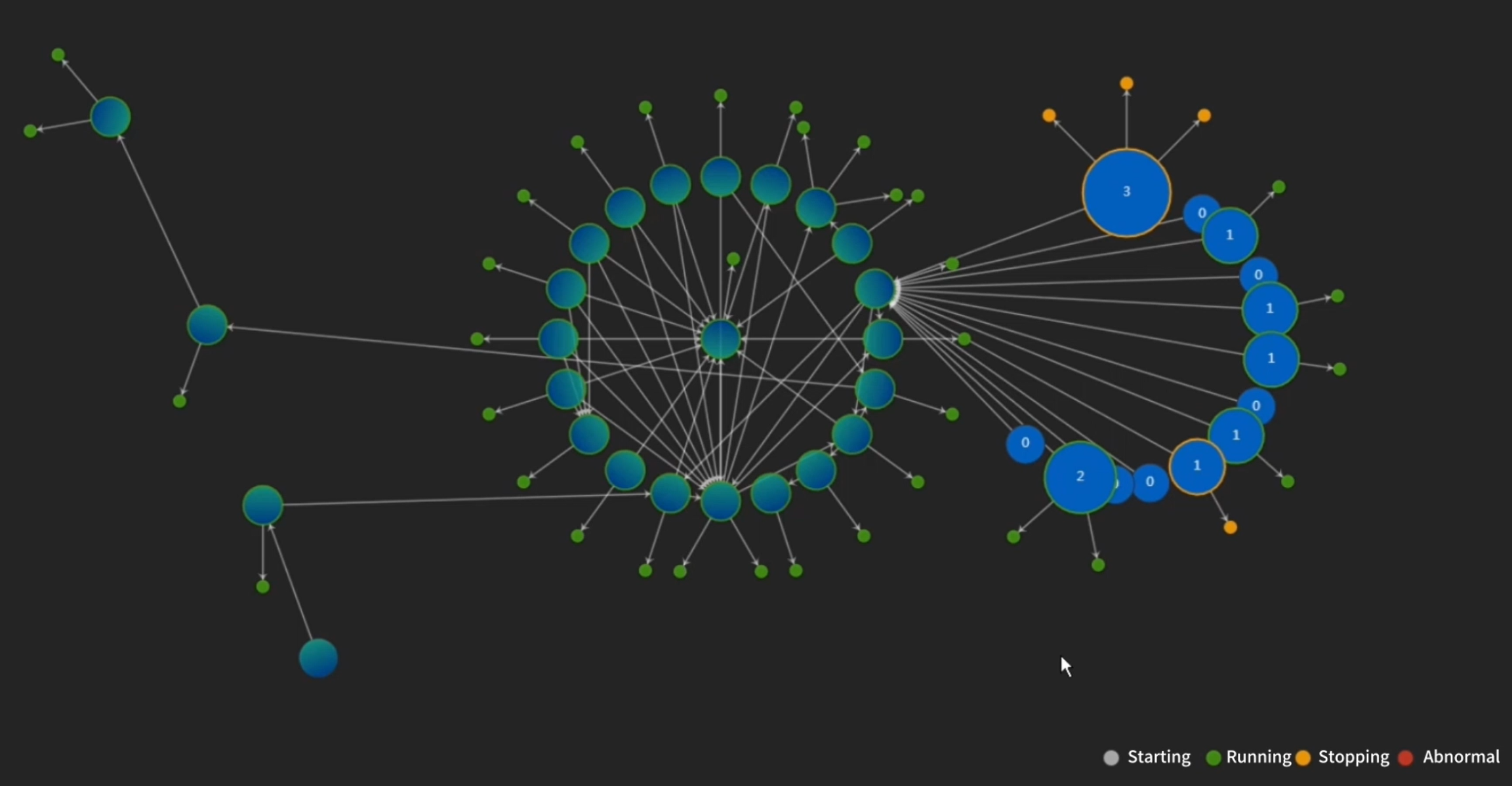
SuperMap released the technology of cloud native GIS 1.0 in 2018, including microservice, containerization, and automatic orchestration. In the era of 2.0, SuperMap introduced service mesh and serverless computing.
Based on the Cloud-Native GIS 1.0 architecture and capabilities represented by GIS microservices, containerization and automatic orchestration technology, SuperMap has newly upgraded and developed GIS Service Mesh and Serverless technology, creating a Cloud-Native GIS 2.0 with “extreme flexibility and toughness”.
Based on GIS Service Mesh technology, it has four functions: service metrics, service trace, access control and gray release, which comprehensively improves the operation and maintenance management ability of cloud-native GIS.
Through GIS Serverless technology, the computing modules of micro services such as spatial analysis in SuperMap GIS 11i(2022) are disassembled into finer grained GIS function computing units, which can be accurately and rapidly executed on demand and expanded flexibly. After the GIS function calculation task is completed, the resources are automatically released to make the resource use more intensive.
GIS Serverless Computing
More Realistic and Faster 3D Rendering
Driven by applications such as CIM (City Information Modeling) and digital twin, the 3D technology in SuperMap GIS 11i(2022) has achieved several innovative upgrades.
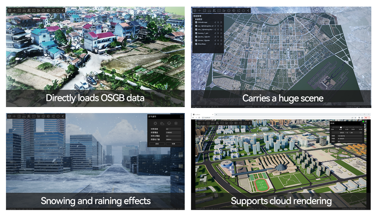
S3M3.0 with enhanced performance and effects. The upgrade of the S3M data format from 2.0 to 3.0 significantly reduces the data capacity and improves the data download and reading speed; it supports OBB bounding boxes and optimizes the data scheduling performance; through skinning and skeletal animation, the animation effects of 3D scenes are enriched; using the mask texture provides a more textured visualization effect; the mesh model supports more dimensional vertex attributes and multi-level semantics, which can be used to express the evolution process of flooding.
High-fidelity 3D SDK with enhanced performance and effects. The high-fidelity 3D SDK, which integrates 3D GIS and game engine across borders, combines game engine materials, mask textures, and material mapping to quickly beautify real-world 3D data such as stretched building blocks, fine molds, and BIM. It supports UE5 Large World Coordinate, showing the real 3D geographic world integrating macro and micro.
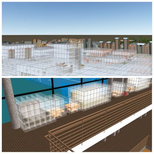
High-fidelity 3D scene browser (new product release). The high-fidelity 3D scene browser is a lightweight desktop software developed based on UE5 and SuperMap Hi-fi 3D SDK. It can quickly access massive multi-source heterogeneous data, achieve high-fidelity rendering engine special effects, and support cloud rendering and publishing to the web.
Self-developed architecture Web3D SDK (new product release). SuperMap has newly released the Web3D SDK product, a self-developed architecture based on WebGL technology, which improves the 3D rendering engine on the Web side and enhances its advantages in realism, GIS functions, data types, and low-code development.
SuperMap iExplorer3D
Advances in SuperMap Desktop and Mobile Products
SuperMap iDesktopX is a 2D and 3D integrated desktop GIS software platform, which can run in Linux and Windows. It has features of spatial data production and processing, distributed data management and analysis, mapping, service publishing, plotting and deduction, processing automation, machine learning, video analysis, etc., which can be used for data production, processing, analysis, migration and service system customization. This year, the upgrades of SuperMap iDesktopX mainly include mapping, automated processing, machine learning, data migration, customized development, and video map. Video Map, as a key new function, supports access to real-time video streams and performs video plotting and AI analysis.
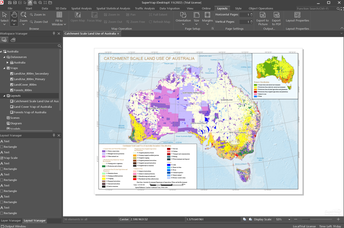
SuperMap iDesktopX
SuperMap UAV Survey is a brand-new mobile product. It is an application software for UAV field collection and mapping, including UAV flight control and video GIS analysis. It has functions of spatial data collection, field investigation, mapping, inspection, monitoring, etc., based on UAV geographic video technology. Focusing on UAV video measurement and collection, UAV video, and map integrated management, SuperMap UAV Survey enables UAV video to perform GIS visualization and analysis.
SuperMap AR Survey is a mobile GIS collection application, with functions encompassing AR, map, collection, 3D, mapping, plotting, analysis, navigation, etc. It supports data interaction of cloud and client integration and extension development.
Cross Platform Mapping and Migration Technology
How to realize the efficient reuse of existing data assets and map assets against the background of accelerating data updates? The data migration and mapping capabilities of SuperMap iDesktopX 11i(2022) solves this problem.
iDesktopX can access multi-source data, and supports one-click migration of PGDB, FGDB, SDE, and ShapeFile data, including point, line, polygon, raster, image, etc. In the new version of iDesktopX, the performance of data migration and storage has been improved by more than 5 times, and the migration of attributes such as data value fields and association tables has been improved. At the same time, it supports the continuous transfer of SDE data in steps, realizes the sharing of PostGIS source databases, and improves the data migration interactive experience.
iDesktopX supports batch migration of maps and layouts in MXD, synchronous migration of map elements and their display styles, including thematic maps, labels, map symbols and other elements.
WebGIS Low-Code Development Technology
In SuperMap GIS 11i(2022) products, the low-code development product system of SuperMap WebGIS is more convenient and efficient in the application construction, and provides in-depth expansion support for industry customization needs. The development tool also provides better performance and experience.
The low-code mapping WebApp – Mapstudio optimizes the mapping mechanism, and can set the symbol, color, size, etc. of layers based on different data attributes, to display spatial data in multiple dimensions on a single layer.
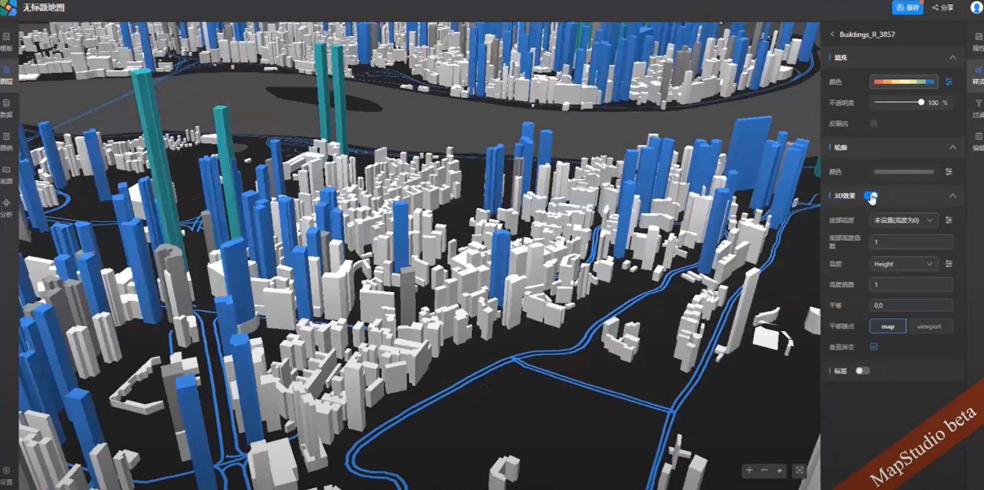
Make 3D Stretched Model Map
In terms of data processing and analysis, SuperMap GIS 11i(2022) provides Web processing automation (WebGPA), which is supported by tools such as data management, traditional spatial analysis and distributed analysis. By adding operators to build business processes in the form of workflow, it can realize the automation of spatial data processing and analysis process without writing code. In this version, nearly 20 operators such as k-means clustering, mean shift clustering and geographically and temporally weighted regression (GTWR) are added to the processing automation, and the modeling page and some operation methods are optimized to improve the user experience.
Low-code application MapDashboard has added more than 10 industry application templates, covering more industries such as resources, environment, agriculture, electricity, etc. The templates also support the adaptive layout of screens of different sizes, such as tablets and mobile phones. The MapDashboard also adds a low-code editor module, which can expand and develop the application online. The low-code editor provides a variety of developer-friendly features, including full life cycle management, one-click event code generation, CSS full style modification, method/attribute intelligent prompt, online fast code execution, etc., to help developers write less code and code faster.


