Overview
The burgeoning information technology, IoT, mobile internet, and cloud computing technology have resulted in the emergence of a comprehensive management service platform for the “smart park” (industrial parks, Hi-tech parks, free trade area, etc) which can get through the data resources process, mines data value, and provide information services for the design, construction, and maintenance of parks.
The Comprehensive Management Platform for Smart Parks relies on key technologies such as cloud computing, big data, AI, etc., and provides a BIM-based integrated platform encompassing the planning, construction, management, and operation of the park by enhancing IoT big data management capabilities. The platform can provide all-around application services ranging from park planning and construction, investment promotion, operation supervision, to security command and dispatch for park managers, decision-makers, and park planning departments, to promote industrial transformation and upgrading.
Framework
The platform is developed based on SuperMap GIS. It is a standard-based, open, extensible, and sharing platform. The system architecture follows SOA and is composed of six layers: software and hardware infrastructure layer, data layer, platform and service layer, application layer, business layer, and display layer. The platform supports the visualization of the park overview, query, statistics, and analysis based on the data service and analysis service.
Functions of the platform
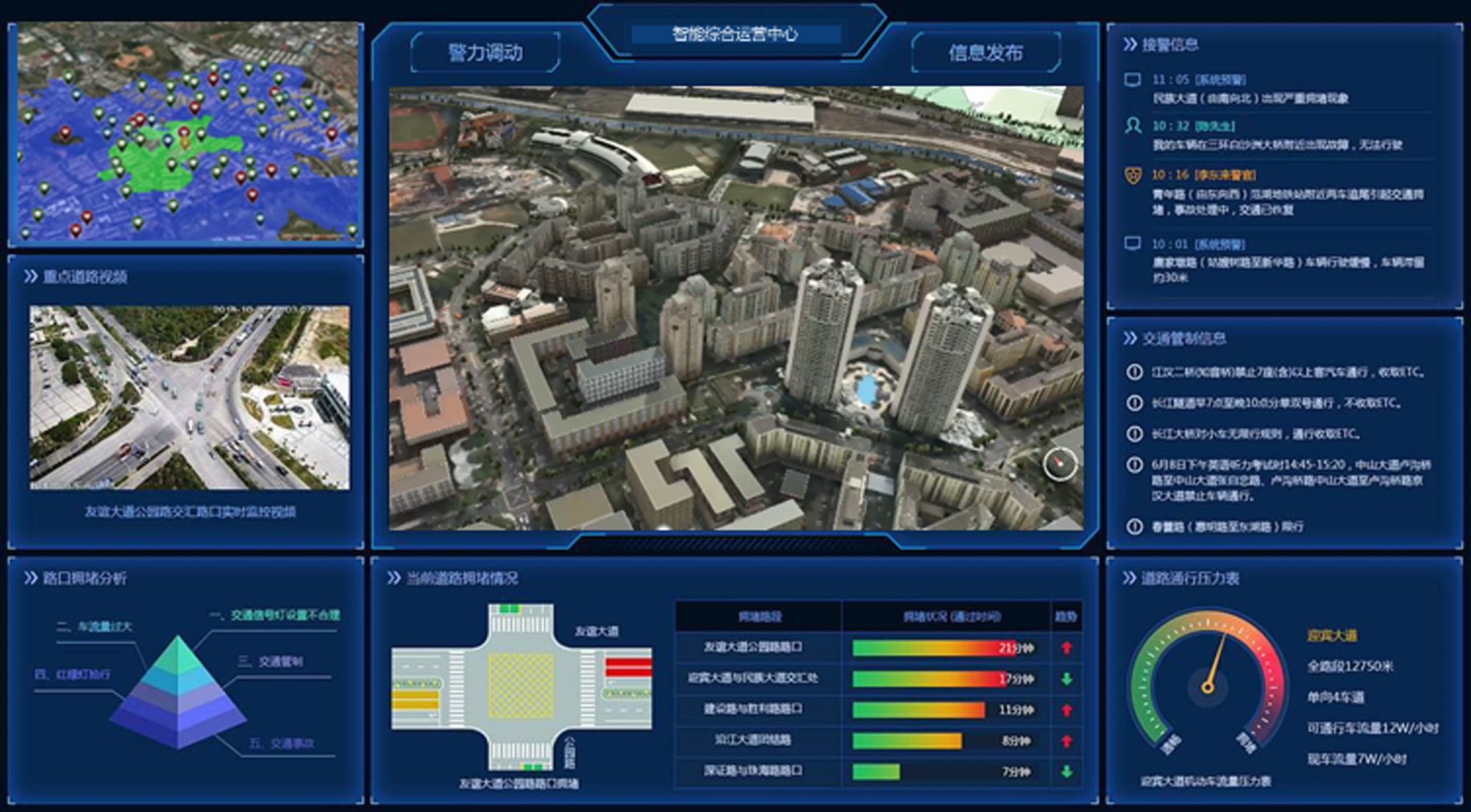
Comprehensive Management Platform for Parks
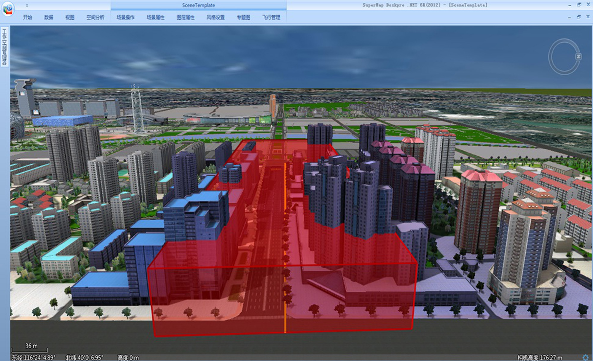
It provides 2D-3D integrated geographic information services for the ground, underground, and all elements of the park, and supplies resource catalogs, and asset ledger services, as well as query and statistical analysis services for various utilities in the park.
Visualization System of Comprehensive Operation in Parks
This system can classify and display various assets in the park through the resource catalog tree, and possesses the functions of 2D-3D integrated display, query, statistics, analysis, and summary of various assets.
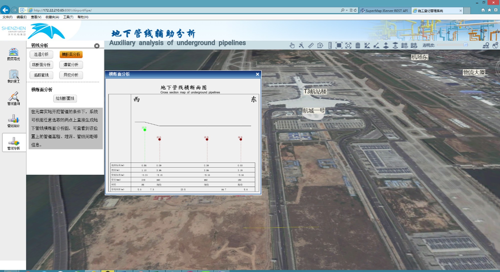
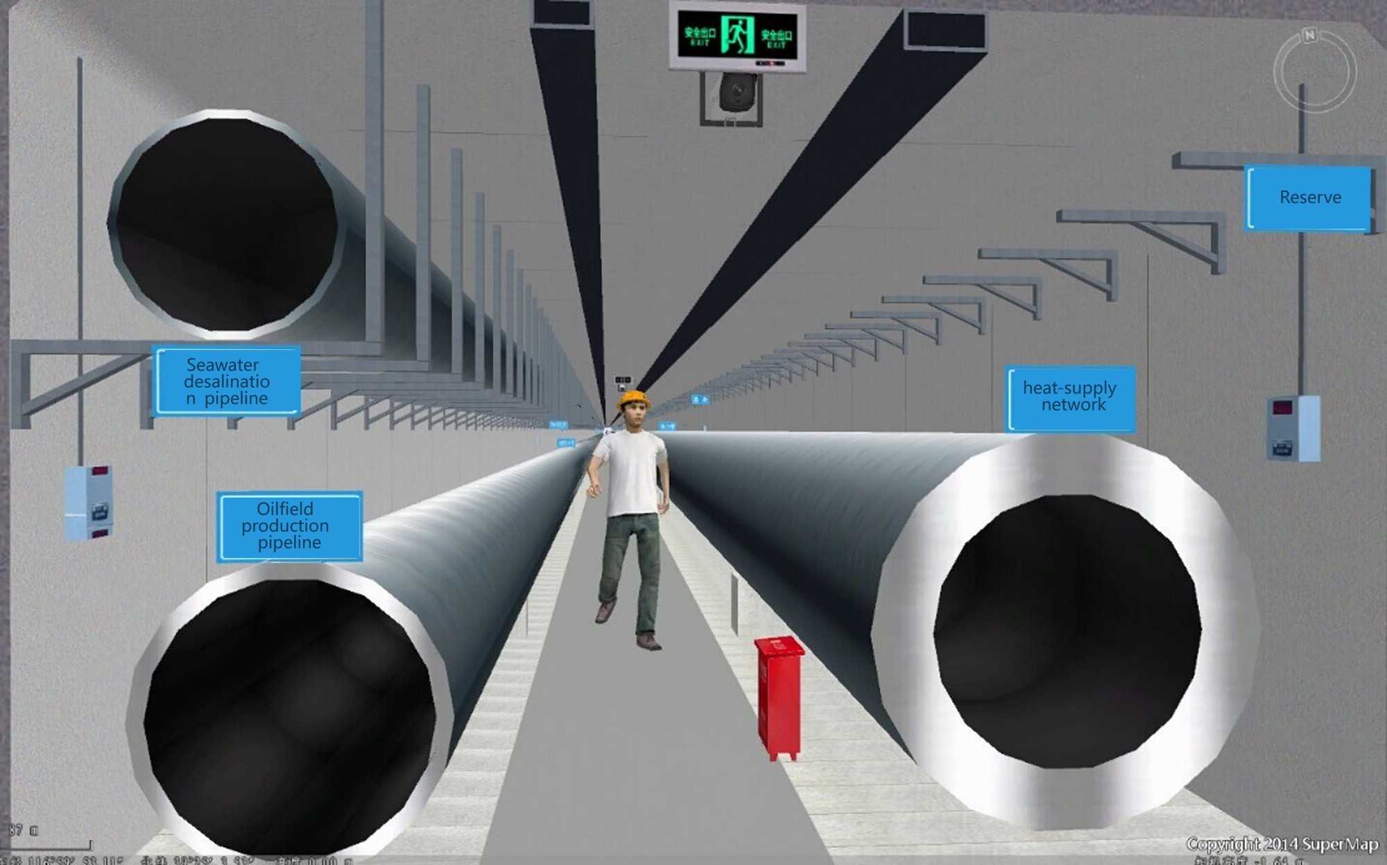
Underground Utility System
It provides real and accurate comprehensive pipeline information, has functions of quick query and statistics, positioning, auxiliary analysis, and decision-making, and provide a reliable basis for the design and construction of the park's pipeline network, daily management after completion, pipeline network maintenance, analysis and statistics, and planning decisions, forming a comprehensive pipeline information system for centralized management and distributed applications.
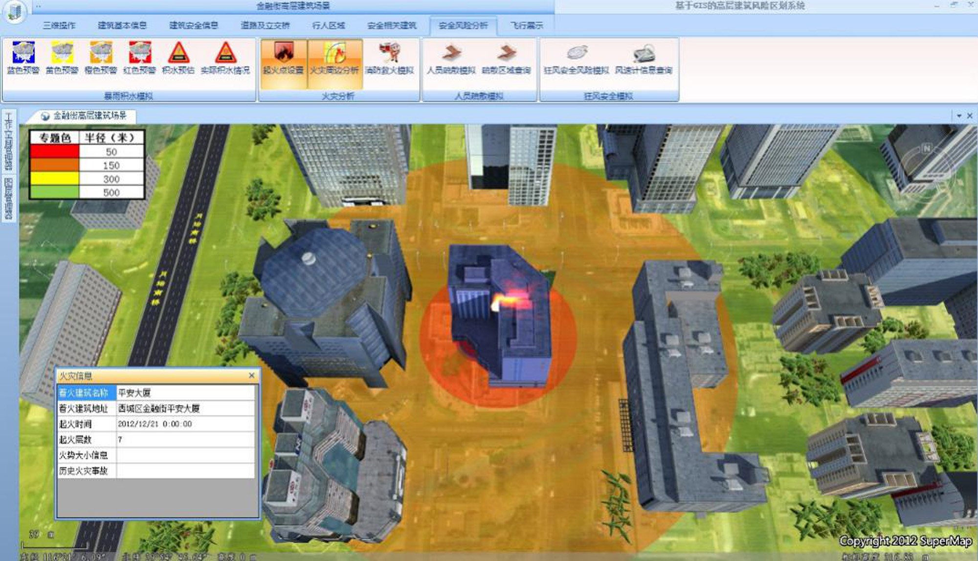
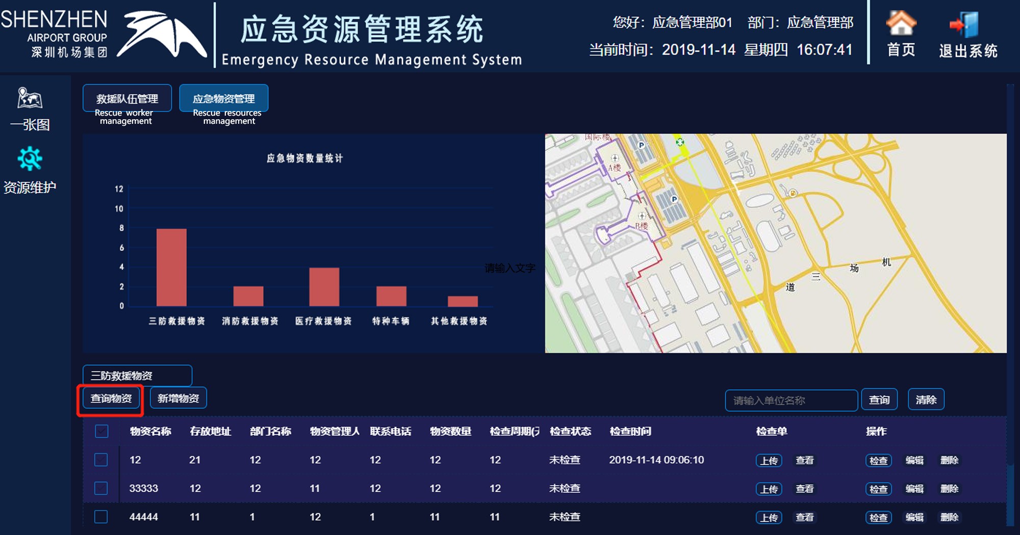
Security&Emergency Response Management System
It is an integration of command and dispatch information system, video and image monitoring system, vehicle positioning system, personnel positioning system, emergency plan system, and emergency equipment management system.
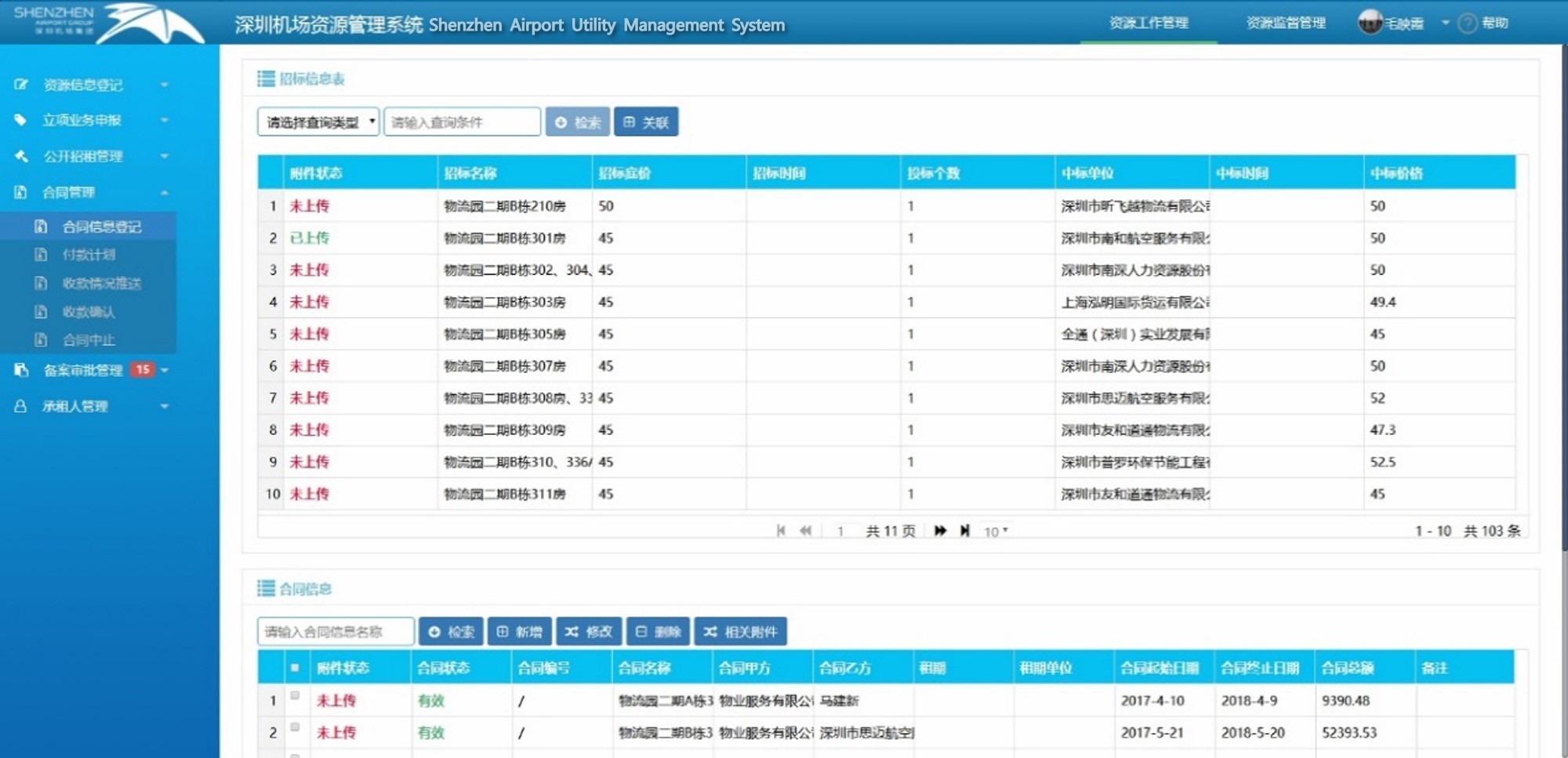
Commercial Lease Management System
This system supports managing leases of buildings, houses, shops, storefronts, advertising spaces, etc. in the park through 2D-3D integration, and registration as well as filing of lease contracts of merchants, and supervision and management of business activities.
Inspection Management System
Using GIS, GPS, or indoor WIFI positioning technology to provide staff with a visual inspection management system to allow hierarchical management of the entire park utilities. The system digitizes all facilities resources involved, allowing managers to be aware of the layout, construction, and maintenance of the overall facility, and allowing inspectors to collect information on the geographic location and related attributes of resources through handheld terminals, allowing managers to view the playback of inspection personnel’s movement information, historical trajectory, and maintenance records.
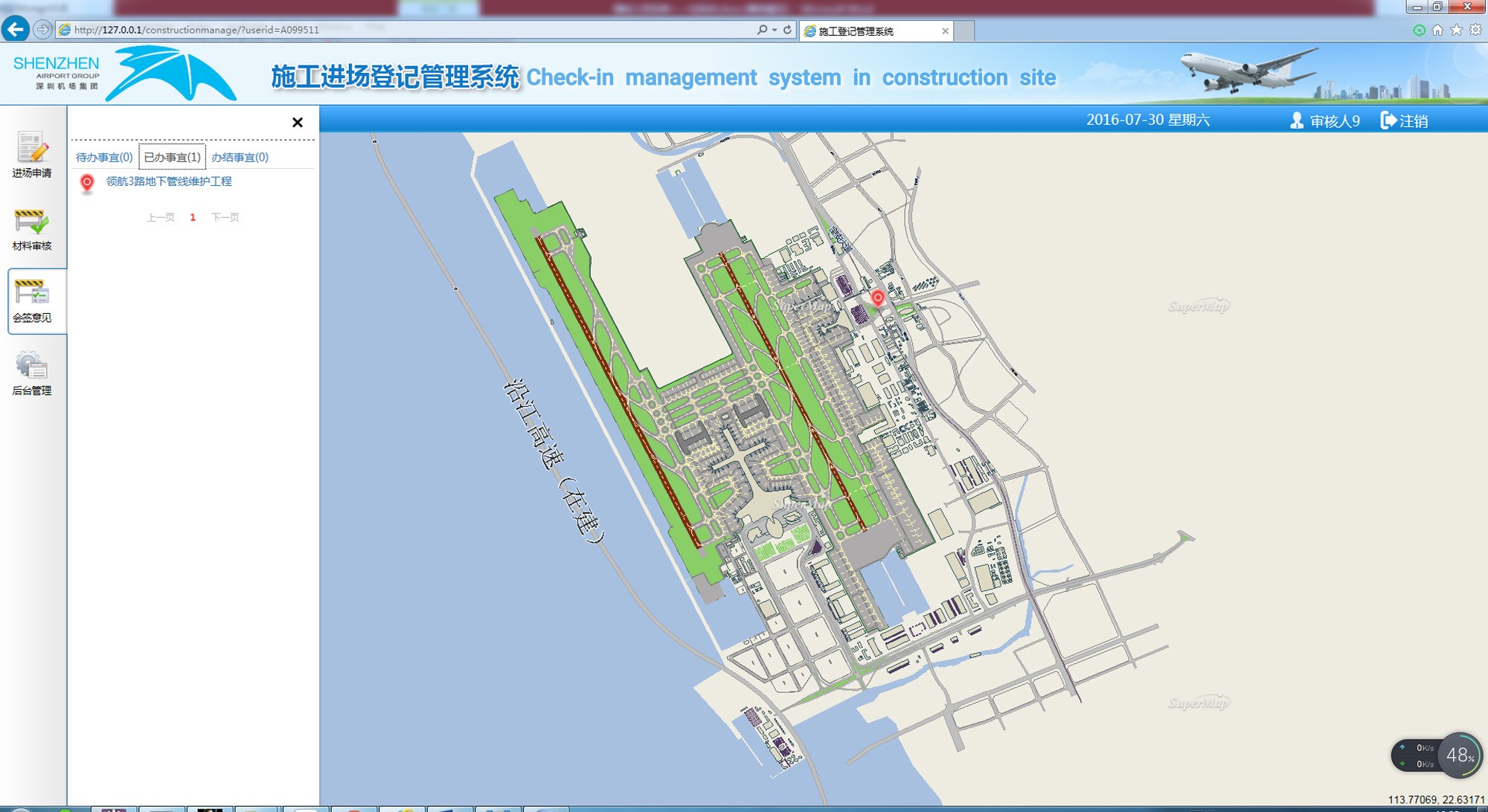
BIM-based Construction Registration and Drawings Management system
This system manages the building project approval process and the construction process carries out the association and storage of designing information, construction drawings, construction process, and data changes of each plot, building, and component.
Auxiliary Planning Management system
The system supports simulating and making decisions on the planning, design, and operation of spatial engineering in the park employing BIM+GIS digital twin technology.
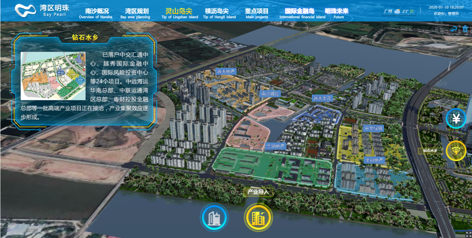
Park Display System for Investment Attraction
This system can exhibit the overall situation of the park in a 2D-3D integrated way to fully display the features of each park including development strategies, investment attraction policies, and shop lease announcements through multimedia.