The recently updated SuperMap Scene SDKs 11i (2021) for game engines Beta, including two 3D GIS plugins aiming at UE4 and Unity game engine, has been released on July 30. What are the new functions and what new experience will it bring? Let’s take a look!
More Powerful 3D GIS Data Visualization Techniques
SuperMap Scene SDKs 11i (2021) for game engines features more powerful 3D GIS data visualization techniques.
• It provides 3D virtual globe pattern and supports the dynamic loading of local/online topography and image data;
• It supports the dynamic loading of massive, multi-source heterogeneous and local/online manual modeling data, real scene 3D model, laser point cloud, BIM model, 3D vector data on the basis of S3M Standard;
• It supports the loading of point, line, surface and model data stored in UDB/UDBX (a file-pattern spatial database), owns data processing functions such as 3D point plug-in assets, 3D line/surface setting materials or plug-in assets, model setting materials, and supports saving model materials to UDB/UDBX in Standard PBR;
• It supports the loading of point, line, and surface data in JSON format, and possesses the data processing functions of 3D point plug-in assets, 3D line/surface material setting or plug-in assets.
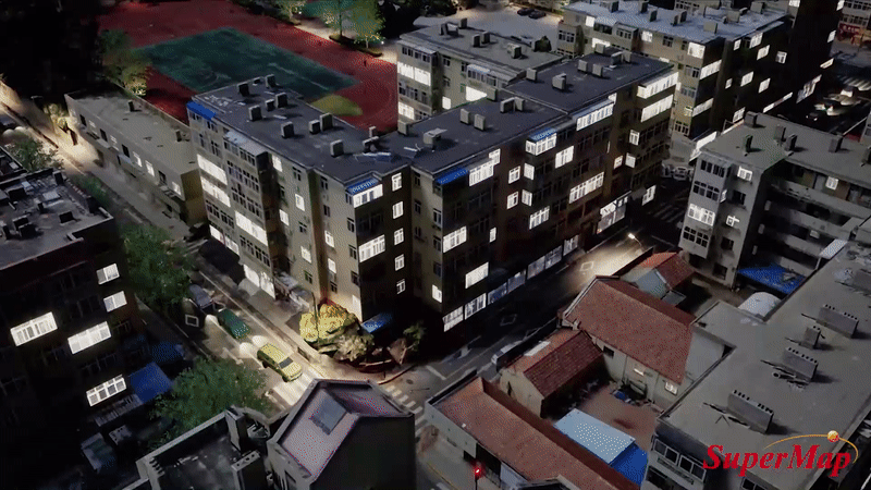
Load Real Scene 3D Model in UE4 Based on SuperMap Scene SDKs 11i (2021) for game engines
More Comprehensive Functions on 3D GIS Analysis and Measurement
SuperMap Scene SDKs 11i (2021) for game engines provides more decision-support tools for BIM+GIS, CIM, smart city and digital twin city with more comprehensive functions on 3D GIS analysis and measurement.
• Visibility Analysis
Visibility Analysis in UE4 Based on SuperMap Scene SDKs 11i (2021) for game engines
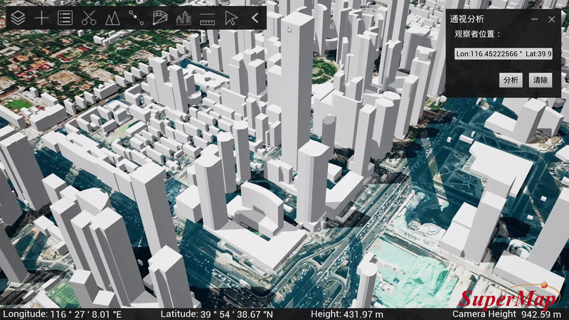
• Viewshed Analysis

Viewshed Analysis in UE4 Based on SuperMap Scene SDKs 11i (2021) for game engines
• Skyline Analysis
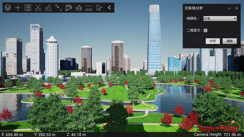
Skyline Analysis in UE4 Based on SuperMap Scene SDKs 11i (2021) for game engines
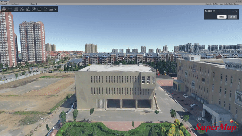
• Partially Flattening Real Scene 3D Model and Adding BIM Model to the Original Site

Partially Flattening Real Scene 3D Model and Adding BIM Model to the Original Site in Unity Based on SuperMap Scene SDKs 11i (2021) for game engines
• Real-time Sectioning Analysis
Real-time Sectioning Analysis in Unity Based on SuperMap Scene SDKs 11i (2021) for game engines
• Measurement: Space distance, Horizontal distance, Area, Height
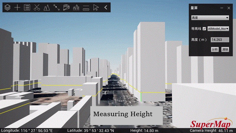
Measuring and Calculating the Height in UE4 Based on SuperMap Scene SDKs 11i (2021) for game engines
• Topography Isopleth Analysis
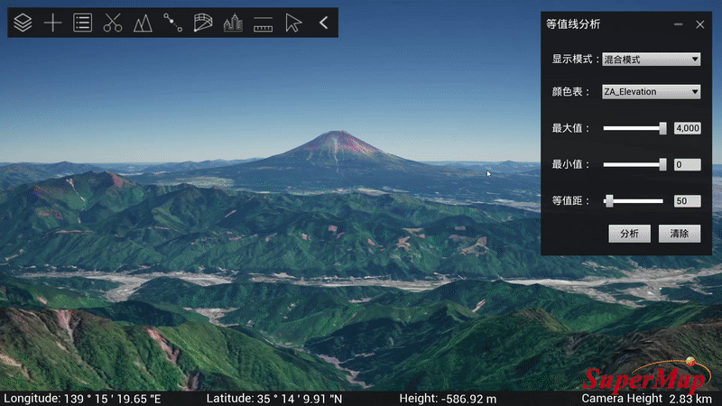
Topography Isopleth Analysis in UE4 Based on SuperMap Scene SDKs 11i (2021) for game engines
• Dynamic Monomerization Representation of Real Scene 3D Model
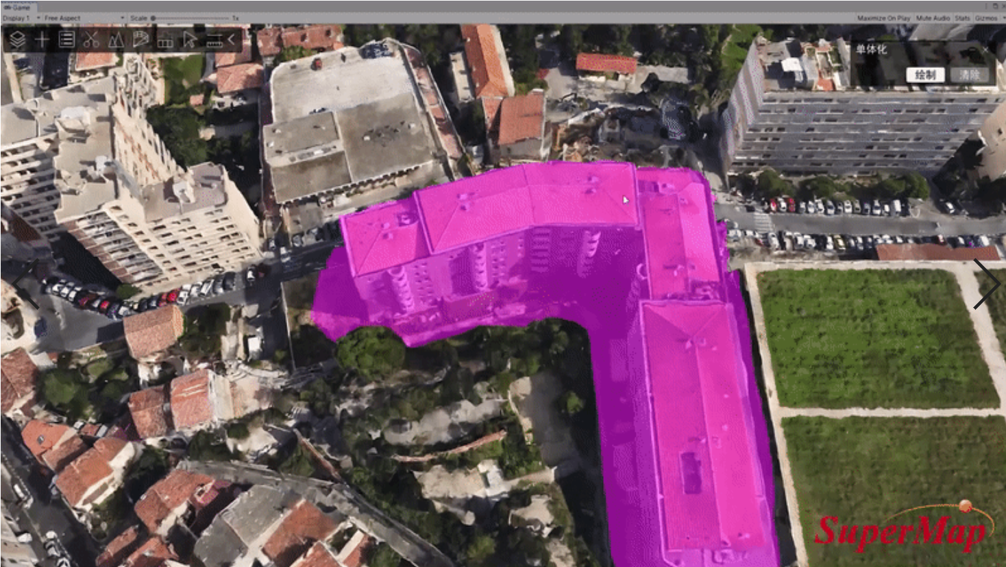
Dynamic Monomerization Representation of Real Scene 3D Model in Unity Based on SuperMap Scene SDKs 11i (2021) for game engines
Brand New Interactive Experience
• Based on UE4+ SuperMap Scene SDKs 11i (2021) for game engines, the SDK is packaged into EXE file, and the operating 3D scene instance is streamed to the Web Browser through Pixel Streaming, and then, the JavaScript API is utilized to interact and develop the application system in the Web browser.
• Based on Unity+ SuperMap Scene SDKs 11i (2021) for game engines, the SDK can be cross-compiled into WebAssembly (Wasm) and by means of JavaScript API, it can render 3D scene and conduct real-time interactions in a Web browser.
In addition, SuperMap Scene SDKs 11i (2021) for game engines includes a set of open-source JavaScript API pattern in order to make development on the Web easier and cheaper for users.
On the strength of these functions, GIS users can make full use of existing resources. Not only can 3D data services originally published through iServer be connected to the game engine, but 3D application systems originally developed with SuperMap 3D WebGL client platform can be easily migrated to the Web of the game engine.
SuperMap Scene SDKs 11i (2021) for game engines official version will be released at the end of September, with many new features to be discovered.


