Key project of Ministry of Land, Infrastructure, Transport and Tourism
Japan is a country with frequent disasters, the central and local governments have carried out multiple projects to prevent disasters. After the long time construction, central and local governments have accumulated massive number of disaster prevention systems. Ministry of Land, Infrastructure, Transport and Tourism of Japan has developed a portal to integrate those systems. However, due to the outdated layer contents, maintenance difficulties, function inconvenience and low speed, the reform of the portal is of necessity.
The reform of the system will become the benchmark for the disaster systems. SuperMap Japan took the reform task and carried out the task within short time, currently the reformed system has been officially published.
1. System objective and construction requirements
1.1. System objective
Geographic area is the whole area of Japan;
Covers basically all of the disaster prevention layers;
linkage publishing with disaster prevention information publishing webpages of over 1,700 cities;
Quick publishing of disaster information from the servers of 47 prefectures across Japan;
Allows administrator customize the vector layer, displaying scale and functions in the system;
Statistics and analysis of the accesses from the world (tracking level is the tile level of each layer);
Developed by the latest web technology (Leaflet, html5, tile Geojson, UTF-Grid, etc);
Security and usability of the website exceed Japan JIS standard and AA level, trying to reach AAA level;
In data preparation, 35 sublayers through vector and raster tilling are needed. Especially in vector tiling, using different kinds of data to tile a nationwide Geojson is a rare project in Japan;
Provides massive documents including animation, brochures, etc.
1.2. Environment of server terminal
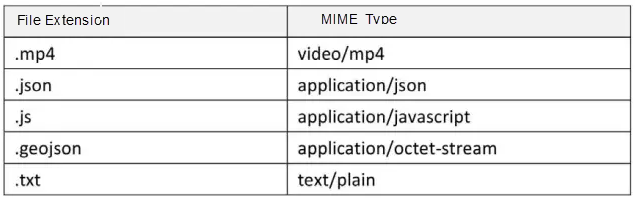
MS IIS 8.5, .Net Framework 4.0, Php 7.0, MySql 5.6, Piwik 2.1.6, SuperMap Objects.Net 7.1.2.
The MIME of the following types need to be added when configuring IIS
1.3. Environment of client terminal
Microsoft Internet Explorer 9, 10, 11, Latest edition of Mozilla Firefox, Latest edition of Google Chrome, Latest edition of Opera, iPhone 6, iPad, Android 4.0or above.
2. Architecture of system
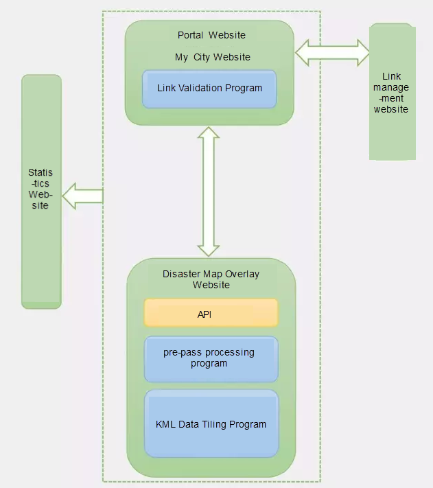
System includes 5 websites and 3 back-end processing programs.
5 websites include: disaster map overlay website, portal website, my city website, link management website, monitoring statistics website.
3 back-end programs include: KML data tiling processing programs, prepass tile processing program, link validation programs.
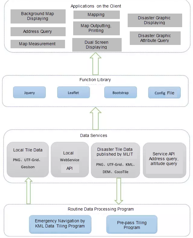
The diagram of the system:
3. Design and realization of disaster map overlay website
3.1. General design
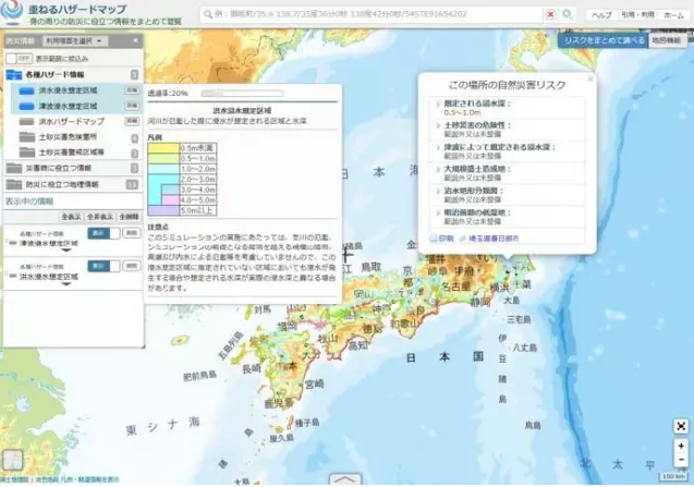
3.2. General interface
There are a lot of contents in the Japan disaster map portal website, and more disaster layers areneeded to be added in the future and to test best parameters setting,like which layers need to be added or deleted, layers are displayed in which scale range, display styles of vector tile, etc. Those parameters need to be adjusted according to the people opinion and real data so that the system can set the layers and parameters as configuration files to let administrator to customize.