Introduction
"3D Real Scene Digital Village Governance Platform" is an award-winning work of the SuperMap GIS Contest.
Building digital villages is one of the key parts of the digital transformation of rural governance. A team participating in the SuperMap GIS Contest designed and developed the 3D Real Scene Digital Village Governance Platform, to achieve multi-terminal information sharing with standardized, modularized functions and unified data standards, so as to assist in the improvement of rural governance and informatization.
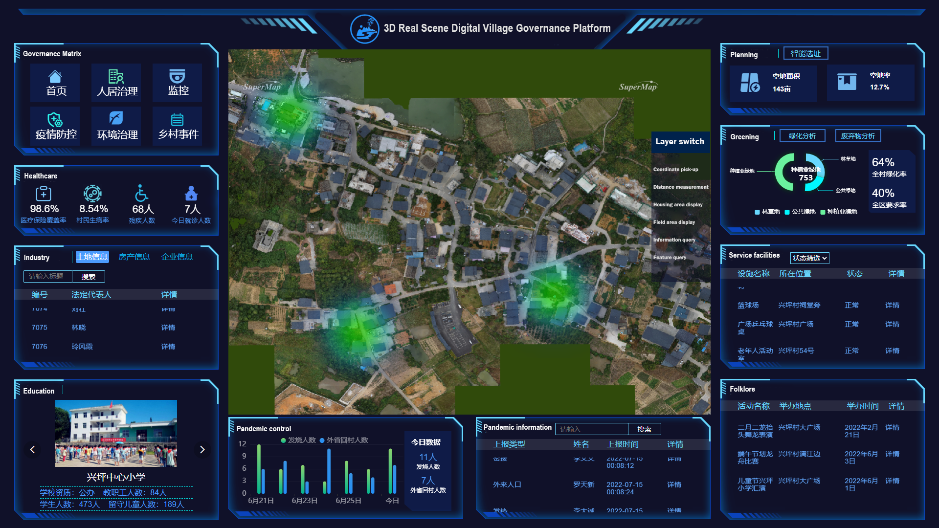
Five major functions to improve the level of rural governance and informatization
The platform regards government personnel, village cadres at all levels, villagers, and management personnel as the main user groups. The system is based on SuperMap GIS software. In order to better serve users, it realizes multi-terminal interconnection. The web terminal is mainly for government personnel, village cadres at all levels and managers; WeChat applets (WeChat Mini Program) are mainly for village cadres and villagers at all levels.
Information monitoring based on the deep learning algorithm
The platform uses the Internet of Things technology to obtain surveillance camera information in real time and store it in the background. At the same time, it uses the pre-trained YOLOv5 single-stage target detection algorithm to identify the surveillance information. After violations such as illegal construction and other violations occur, the system will automatically call the police. In daily circumstances, in case of emergencies, villagers can use WeChat to report emergencies. The system can call the police after receiving corresponding emergency events, quickly understand emergency states and make corresponding decisions.
Intelligent site selection based on 3D space planning analysis
Through algorithms, the platform can assist relevant personnel in site selection for building land and public facility land. Compared with spatial analysis based on interpolation methods in two-dimensional data, this system can display the boundaries of three-dimensional spatial entities, and intuitively show architectural planning and occupancy space to help rural planning.
Greening analysis
In order to make up for the shortcoming that the 3D tile map only has visible light band information and it is difficult to carry out data statistics in a large range, the platform uses 2D UAV images, combined with field monitoring data to invert the water quality and Fractional Vegetation Cover (FVC) of villages and towns, combined with principal component transformation and precipitation data, analyzes the vegetation and crop health status in villages and towns, assisting in future rural vegetation management and greening construction.
Waste analysis function
The platform adopts GIS and Internet of Things technology, uses the water quality and meteorological information obtained by the monitoring site to analyze the buffer zone, and generates a thermal map of environmental pollution. Through technical means such as discrete values, weight algorithms and analysis models, the waste concentrations are displayed in color blocks.
Information query
Using the information query function of the platform, you can query the property rights information of the built houses, the land property rights information of the planted fields, etc., and highlight them on the 3D village map, which is convenient for village-level cadres to manage the village. In addition, the function of feature query also supports the automatic positioning of features.


